New Cornish off-road cycle route highlights England's lost rights of way

- Many ancient routes were not recorded properly when councils compiled their official rights of way maps
- The West Kernow Way includes several of these “lost ways”, including an ancient trackway known as the Tinners Way
- These ancient routes could form crucial links in our rights of way network but risk being lost forever if they are not identified and submitted for recognition by January 2026
- Video illustrating lost ways available below; images and maps also available
With the launch of its new long-distance cycling route in Cornwall, Cycling UK is warning that many historic rights of way could be lost in England if action is not taken urgently.
In its new video, aimed at the off-road cycling and mountain biking community, the charity outlines the problems facing cyclists who want to go where the tarmac ends, and what they can do about it.
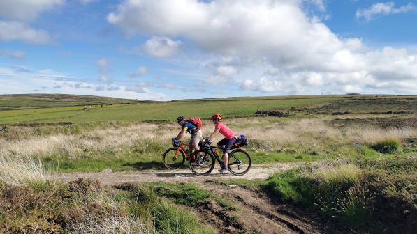
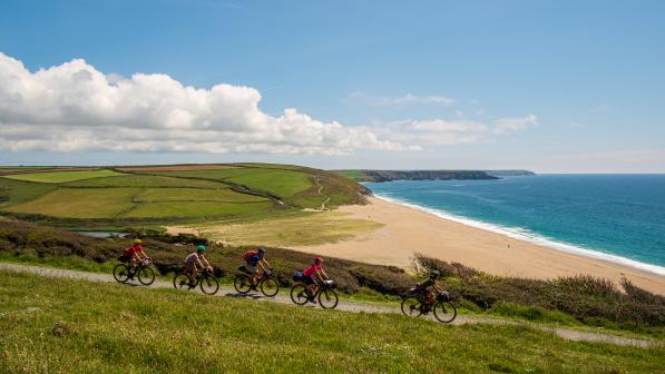
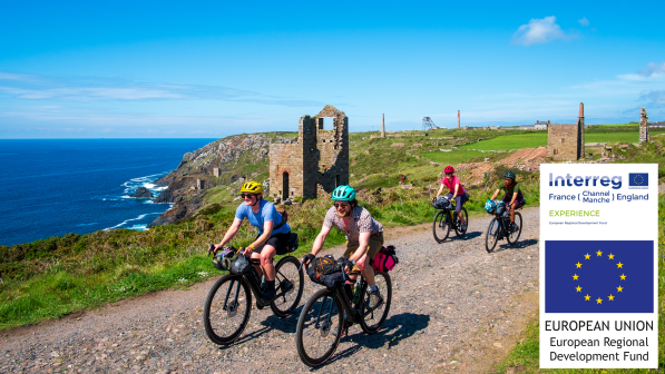
The 230km West Kernow Way, developed by Cycling UK as part of the European Regional Development Fund EXPERIENCE project, provides a snapshot of the problem off-road cycling faces across England and Wales.
The new route includes several stretches of path and track that are officially recorded as footpaths – which cyclists do not have a recorded right to use – or in some cases not as a public right of way at all. Among these is the Tinners Way, an ancient track with a history dating back to the Bronze Age. Also known as the ‘Old St Ives Road’, it got its current name from being used to transport tin from Cornwall’s mines in the 18th and 19th centuries. Despite this long history, official rights-of-way maps don’t show access rights for horses and carts (or bicycles).
Sophie Gordon, campaigns officer for Cycling UK said:
“There are thousands of historical anomalies like this in the rights of way network across England, where routes were recorded incorrectly when councils were compiling their official maps in the 1950s.
“However, the key thing is that the public’s right to ride on them still exists. It hasn’t just disappeared because they’ve been marked incorrectly on a map. These ancient routes which used to be used by horses and carts could form crucial links in our fragmented rights of way network, where currently only 22% is open for cycling.”
Currently, the only way to correct this situation is to submit an application for a Definitive Map Modification Order (DMMO) to the local council, but there is such a backlog of applications that it would take councils an average of 15 years to deal with them all. Additionally, there is a deadline of January 2026, after which no new applications to recognise historic rights of way will be accepted.
DMMOs have been submitted for all of the “lost ways” included on the West Kernow Way, but Cycling UK believes it is not practical to wait 15 years for the maps to be corrected.
“It’s clear that the system needs to be simplified, because we are missing vital opportunities to restore crucial links in England’s right of way network for cyclists,” Gordon said. “Making it easier for people to get out on a bike and be active would have huge benefits, both for public health and for the rural tourism economy. This is something as a charity we’re looking to change, but the off-road community can help too.”
For more information on how to record lost rights of way in England and Wales, see https://www.cyclinguk.org/lostways.
Notes to editors
- Cycling UK, the UK’s cycling charity, imagines a world where the streets are free of congestion and the air is clean to breathe, where parents encourage their children to cycle to school and everyone shares the exhilaration of being in the saddle. For more than 140 years, we’ve been making our streets safer, opening up new traffic free routes and inspiring more people to cycle more often. www.cyclinguk.org
- The West Kernow Way, a 230km circular bikepacking route through west Cornwall, was launched on 3 September 2021. It forms part of the European Regional Development Fund EXPERIENCE project, which aims to develop sustainable off-season tourism activities across six regions in England and France. As part of the project, Cycling UK will also be supporting hospitality businesses along the route to become accredited Cycle Friendly Places. For more information on the route see https://www.cyclinguk.org/west-kernow-way.
- Further images and maps of the West Kernow Way are available at https://www.skyfish.com/p/cyclinguk/1958064.
- Cycling UK has created a “story map” illustrating the lost ways of the West Kernow Way, which can be viewed at https://storymaps.arcgis.com/stories/c129c4f9fb644a94b851949face73249.
Press contact information
For more information, please contact the national Cycling UK press office. Due to the restrictions caused by the coronavirus outbreak, currently the main press office number (01483 238 315) is not being monitored. If you would like to speak to a member of the press office during working hours (0900 - 1700) please call Rob Kingston on 07880 424 912 or email [email protected]. Out of hours, call 07786 320 713.


