Royal Chilterns Way: map and GPX file

Named for its many regal connections, the Royal Chilterns Way begins in Reading, part of the Royal County of Berkshire. This is where kings were crowned, abbeys built, and monarchs laid to rest. Reading Abbey, founded by King Henry I in 1121, played a central role in medieval England and is where the king himself was buried. The remains of the abbey, dismantled during the Reformation, can still be explored near the start of your journey.
From there, the route climbs into the ancient beech woodlands and rolling chalk hills of the Chilterns, crossing into Buckinghamshire, whose name lives on in Buckingham Palace. You'll visit Henley-on-Thames, home of the Henley Royal Regatta, and pedal through quaint villages like Great Missenden, where Roald Dahl found inspiration.
This route blends wild beauty and quiet trails with historical richness. From Iron Age hillforts to Victorian estates, it’s a true celebration of England’s cultural and natural heritage.
Royal Chilterns Way route guide
Our comprehensive route guide is will open your eyes to the rich history and stories of the landscapes you’ll journey through.
The guide contains everything you need to plan your ride. The route is broken down into six parts, with detailed maps, navigation and what to look out for along the way. It also includes practical advice so you can make the most of your ride.
Buying the guide contributes to Cycling UK’s vital work in improving cycling for everyone and allows us to create more great routes for you to enjoy.

Route overview
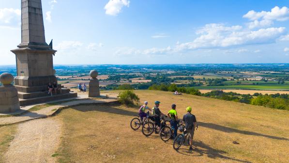
The Royal Chilterns Way is a 280km (174-mile) bikepacking route, weaving through the beauty and history of the Chiltern Hills National Landscape. Around 65% of the route is off-road, mainly following bridleways, byways, and forest tracks, connected by tranquil lanes and peppered with ancient trails, hillforts and chalk-cut artwork that hint at thousands of years of human habitation.
Divided into three logical loops, it offers flexibility:
- Southern Loop: 68km / 880m elevation
- Central Loop: 105km / 1850m elevation
- Northern Loop: 102km / 1845m elevation
Terrain
The Royal Chilterns Way is defined by chalky ridgelines, sun-dappled woodlands, and ancient tracks. Expect a wide range of terrain:
- Flowing gravel and dirt bridleways
- Leafy woodland singletrack
- Steep, punchy climbs and fast, fun descents
- Quiet country lanes to connect the wild sections
Chalk trails drain well and ride beautifully in dry conditions but can become slippery when wet. The lower clay soils are best avoided during prolonged rain. Most of the route is suitable year-round with the right equipment and preparation.
You may need to push occasionally on steep pitches or loose tracks, but your reward is access to peaceful, remote-feeling countryside, surprisingly close to London.

Bike choice
Both gravel bikes and hardtail mountain bikes work well here. The terrain isn’t very technical, but rooty woodland and chalky climbs can challenge riders, especially when wet.
- Hardtail MTB: Offers maximum comfort and control on rougher trails.
- Gravel bike: Fast and efficient on lanes and tracks. Use wide tyres (40mm+), tubeless setup, and low gearing for the short climbs.
E-bikes are also a great choice. Assistance on the hills is appreciated and there are plenty of café charging points along the way.
Navigation
The Royal Chilterns Way is not signposted, but it shares some paths with signed trails such as the Ridgeway and Icknield Way. Some woodland paths include helpful arrows painted on trees. White arrows with a blue line at the base indicate bridleways.
- Use a GPS device or smartphone with the GPX file to stay on track.
- Carry an OS map as a backup, especially for remote areas.

Facilities
The Chilterns are rich in cycling-friendly amenities. The route connects with:
- Independent cafés, pubs, vineyards and farm shops
- Boutique B&Bs, hotels, campsites and even converted churches
- Bike shops in towns like Reading, Tring, Henley and Chesham
Use a live Google map for the most up-to-date information on services and route changes.
Kit and Safety
How much you carry, and whether you choose to wild camp, stay in small campsites or check into boutique B&Bs, depends entirely on the kind of experience you want to have. The Chilterns may be close to London and full of charming villages, but there are still several long stretches of trail through remote-feeling woodland and exposed ridgelines where help is not always close at hand if something goes wrong.
That means packing spare layers, a waterproof shell and basic tools is essential, even in good weather. We also recommend carrying a survival blanket or bivvy bag, especially outside the summer months. Bring bike spares such as chain lube, tubeless repair plugs or patches, spare brake pads and a first aid kit. Make sure you know how to use everything you pack. Always carry more food and water than you think you will need, particularly in quieter stretches such as between Wendover and Christmas Common or when crossing the central Chiltern escarpment, where shops and cafés may be few and far between.
Phone signal is generally reliable across most of the route. However, if you are riding solo, it's important to let someone know your itinerary and estimated timings. As with any longer off-road trip, we strongly recommend riding with others for both safety and enjoyment.

Top tips
- Ride responsibly: Show respect for all other users and take care of the environment
- Leave no trace: Practice low impact cycling. Don’t skid, follow existing paths, ride through puddles rather than widening tracks and avoid muddy trails where possible. Never leave litter and clear up rubbish from other users too.
- Control your bike: Stay focused, check your speed and think about other people.
- Avoid disturbing animals: Farm pet and wild animals can all be startled by sudden noise. Always be considerate, give them a wide berth and leave gates as you find them.
- Plan ahead: Know your bike, your equipment, your ability and be aware of the terrain you’re riding on. Be prepared for severe weather and potential mechanical issues.
- Always give way: Let people know you’re coming with a bell, whistle or cheery hello. Pass wide and slow particularly with horse riders. Approach blind corners and descents carefully. Be Nice, Say Hi!
© 2025 Cyclists Touring Club trading as Cycling UK. All rights reserved.


