Cycling UK's Surrey Hills loop

This route devised by Cycling UK's off-road advisor, Kieran Foster, is thoroughly waymarked on sections of the Cycle Surrey Hills off-road network, and is part of a project delivered by Surrey Hills AONB in partnership with Cycling UK.
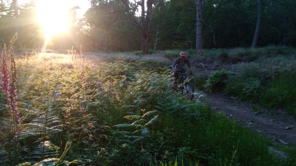
The route begins at Frensham Great Pond, and sets off clockwise, along the wooded bridleways and onto the sandy heath. Expect more of this! Lots of deep sand in places mean traction problems in the summer months, and you’ll crave bigger tyres while a good line choice is essential. However the routes are often easier after some rain and run fast on frosty mornings.
Follow the way marks, but be warned there are a myriad of trails and its easy to slip off the definitive line of the bridleway, but still be headed in roughly the right direction. After a short stretch of road you’ll turn right towards the National Trust managed little pond area, then follow more bridleways past a local microbrewery (the tap room is sometimes open to the public...) and eventually round to Tilford Village, with its pretty cricket green, before bouncing south and along the edge of the military training area at Hankley Common (please take a moment to stop and read the safety notices regards Ministry of Defence training areas).
After passing through Elstead village, you'll then skirt around the edge of the National Nature Reserve at Thursley common, an important area for its ground nesting birds and invertebrate communities. It's a remarkable contradiction, the landscape you’re passing through could be in the Scottish Highlands - but you’re just 30 miles from central London, with the only thing giving the game away being the constant roar of traffic from the nearby A3 to Portsmouth.
Luckily, you can avoid all this with a mile of almost traffic free quiet lane which was closed off when the Hindhead tunnel was built and the tarmac route of the old main road torn up in order to return it to nature. Fortunately they’ve kept a narrow strip that is now a bridleway and byway, and this makes the long climb to the top of the Devils Punchbowl almost bearable. Reward yourself with coffee and cake at the National Trust visitor centre before descending back down the hill and onto more sandy trails as you cross Hankley Common.
Here's your opportunity to divert and see the Atlantic Wall at grid reference SU884413, after which head westwards and along the edges of Frensham common, passing back round the great pond to where you started.
If you’re still up for some punishment, the great pond has a popular open water swimming area where you can take the plunge - but watch out for blue green algae!
History
The route passes a number of scenic historic sites, including medieval bridges in Tilford and ancient turnpike roads near Hindhead, however the jewel in the crown of this route is the extensive section of Atlantic Wall fortifications created by British and Canadian troops on Hankley Common in order to practice for D-Day. It includes a 100 metre long, three metre high recreation of the anti-tank walls witnessed on the Normandy beaches that shows clear signs of the explosive breaching techniques practiced in order to begin, in Eisenhower's words, "the great crusade".
Best Bit: The views
Worst bit: Did I warn you that some bits could be sandy?
