Royal Chilterns Way: your questions answered

- What are the best places to start the route?
- How do I get there and back, and can I leave my car for a few days?
- How long does it take to ride the route?
- Which kind of bike is best?
- How difficult is it? What’s the terrain like?
- Is there information about accommodation and facilities along the way?
- Can I ride it in either direction?
- Is the route signposted?
What are the best places to start the route?
Reading is the recommended start point thanks to excellent train connections and facilities, but the loop design means you can begin at any point. Tring, Henley-on-Thames and Princes Risborough also make good entry points, especially if you're riding one of the shorter loop options. All of them have train stations and nearby parking.
How do I get there and back, and can I leave my car for a few days?
By train
The Royal Chilterns Way is extremely well connected by rail. Reading is the suggested starting point, with fast and regular services from London Paddington, Oxford, Bristol, and beyond. Henley-on-Thames, Tring, and Princes Risborough are also close to the route and served by direct trains. Many stations allow easy bike access and several have step-free platforms.
Train services are frequent, but bike spaces are limited, so it is worth booking in advance where possible. On certain operators such as GWR or Chiltern Railways, you may need a bike reservation. Check the train company’s website for details and allow time at either end of your ride.
By car
If you are driving, Reading offers long-stay parking options such as Queen’s Road Car Park or Reading Station Car Park. Smaller towns like Tring, Henley, and Chesham also have multi-day pay-and-display car parks. Always check signage or local council websites to confirm time limits and costs if leaving your vehicle for several days.
How long does it take to ride the route?
The full loop is approximately 280km (174 miles). Most riders take between three and five days, depending on pace, weather, and how much time you want to spend exploring towns, cafés and heritage sites along the way.
The route is divided into three logical loops, so it is also easy to break the ride into smaller sections over several weekends or shorter trips.
Which kind of bike is best?
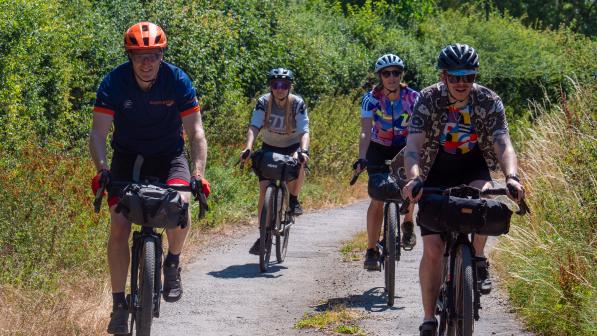
The Royal Chilterns Way is best tackled on either a gravel bike with wide tyres (40mm or more) or a hardtail mountain bike. The surfaces vary from smooth forest tracks and bridleways to loose chalk paths, rooty singletrack, and quiet country lanes.
Gravel bike: Fast and efficient on the rolling terrain, but choose low gearing and durable tyres. A tubeless setup is highly recommended to avoid pinch flats on rougher sections.
Hardtail MTB: Ideal for comfort and control, particularly if you are carrying bikepacking gear or riding in mixed conditions.
Electric bikes are welcome too. Just be sure to plan for battery range and check for charging options along the route.
How difficult is it? What’s the terrain like?
The Royal Chilterns Way is moderately challenging, with constant rolling terrain that adds up over time. While there are no huge climbs, expect plenty of short, steep efforts and a mix of surfaces including gravel tracks, chalky farm roads, rooty woodland trails and quiet tarmac lanes.
Some sections are fast and flowing, while others can be rough or slippery, especially after rain. Chalk and clay can be particularly greasy when wet, so conditions play a big role in difficulty. A well-packed bike and confident handling will make a big difference.
The route is best suited to riders with off-road experience and decent fitness, but less experienced riders can enjoy it too by taking one of the shorter loop options and riding at a more relaxed pace.
Is there information about accommodation and facilities along the way?
Yes. The route passes through or near many villages and towns with accommodation options ranging from campsites and hostels to boutique B&Bs and hotels. There are also plenty of cafés, pubs and farm shops along the way, especially in the central and southern loops.
When the full route guide launches, it will include detailed information about food, drink and accommodation stops, along with recommendations for resupply points and bike shops.
Can I ride it in either direction?
Yes. The Royal Chilterns Way is a circular route and can be ridden in either direction. It was originally planned with a clockwise direction in mind, which helps place the longer or steeper climbs on smoother tracks and keeps the more technical descents on trails that ride better going down than up.
The route is also designed to be highly flexible. It can be broken into three smaller loops, each offering a rewarding two-day ride. This makes it easy to tackle the route in stages over multiple weekends or to choose a shorter section if you are limited on time. These loops each start and finish near train stations, giving you the option to plan a trip that suits your schedule, fitness level, or travel needs.
- Southern Loop: 68km / 880m elevation
- Central Loop: 105km / 1850m elevation
- Northern Loop: 102km / 1845m elevation
Is the route signposted?
The Royal Chilterns Way is not officially waymarked. It does share short sections with existing trails such as The Ridgeway and the Icknield Way, which are signed, but the full loop requires navigation using a GPS device, smartphone app, or printed map.
We recommend downloading the GPX file from the main route page and checking for any temporary diversions or updates before setting off. You can download the GPX file on the main route page.


