How to use Cycling UK’s journey planner

Cycling UK’s journey planner is one of our most popular pages, and with good reason. It’s a very useful tool for planning your cycle route – whether that’s from the train station to your office or a club ride to a new tearoom that’s been on your radar.
But if the journey planner is unfamiliar, you might find that you’re not sure how best to use it. Here I go through it step by step so you can use it to plan your next cycling adventure.
Where to find journey planner
First things first: do you even know where the journey planner lives on our website? You can click the link but that won’t help if you’re not reading this article at the time you want to access the planner.
To find it, click on Go Cycling in the main menu and then select Planning your route. Now you’ve got it, bookmark it. It’s a good idea to bookmark it on your phone too.

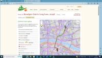
Once you’ve accessed the planner, you’ll see it consists of a map and very simple form allowing you to enter your start point (‘From’, on the page) and your destination (‘To’). You can enter the names of towns or cities – Cambridge to Ely, for example. This will generate a route starting and ending at central locations in your chosen towns.
You can use street names, too, but if it’s quite a common one then it’ll be harder to locate the one you want. High Street, for example, is going to generate a lot of options.
For more accuracy, you can use postcodes instead. If you don’t know the postcodes of your start or destination points, you can find them on Google Maps. Enter a road name or the name of the café or point of interest in Google Maps and the service will give you the full address including the postcode.
Generating your journey
A real-life journey of mine is from London’s Liverpool Street Station to Cycling UK’s office in Borough. Entering the postcode for both, I can then select which mapping platform to use. We’ve worked with both cycle.travel and CycleStreets to provide mapping, giving you slightly different options. Try them all to see how different – or otherwise – the generated routes are.
There are various options. cycle.travel offers an ‘any’ route plus ‘off-road’. CycleStreets has ‘quiet’, ‘balanced’ and ‘fast’. Note that this last option might involve quite busy main roads, so keep that in mind when making your selection.

For my short, very urban journey there’s little to choose between the different platforms. With a longer journey, however, you’ll get different routes depending on your choices.
Once you’ve generated a route you can view it on the relevant platform’s own website, where you can access much more detailed information. This includes a route summary, more granular mapping and turn-by-turn directions.
Riding your route
You’ve now got your route mapped out and plenty of information about it on your computer. But unless you’re going to strap your laptop to your handlebar, it’s not doing you much good. There are a few options here.
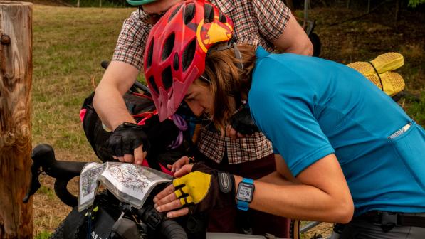
First, and most ‘old skool’, both CycleStreets and cycle.travel allow you to download and print a PDF of your route which includes all the turn-by-turn directions. With cycle.travel you will have to create a free account so you can save your route first.

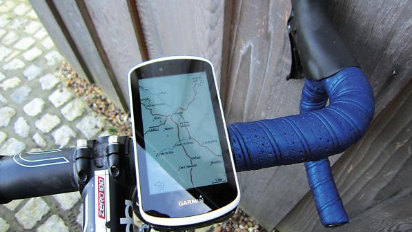
Most useful, for anyone with a smartphone or bike computer, are the GPX files. A GPX file is a text file that contains geographic information such as waypoints and routes. They’re used to create, follow and share routes using a GPS device.
Click on the ‘GPX’ button to download the file. You can give it a more descriptive name before saving it. To use it, you’ll need an account with a route planner. If you’ve got a Garmin bike computer or activity tracker, you’ll already have an account with Garmin Connect. Other free services include Ride with GPS and Komoot.
Using the GPX
Now, you need to be able to access your GPX file on whatever device you’re using to follow the route. If you’re using a bike computer, the instructions will differ depending on what device you’ve got. Check the manufacturer’s instructions.
With my Garmin, I uploaded the file to my account using the website, found it in Courses under Training & Planning and clicked on ‘Send to device’. The route appeared on my bike computer when I next synced it with the website. Garmin’s phone app does have your routes on it, but you can’t use the phone for navigation.
To use a phone, you’ll need one of the navigation apps. As they’re free, there’s nothing to stop you trying several to find out which suits you best. I’m happy with Komoot but a lot of people prefer Ride with GPS.

You’ll need to upload the file to your account. Once there you’ll be able to edit it if you want. I’d recommend giving a meaningful name to make it easier to find. You can either do this here or at the earlier download stage. The route will now be accessible in your phone app and you’ll be able to use this to navigate the journey.
An alternative method is to use the web browser on your phone to generate the route and download the GPX directly to the phone. Find it wherever your phone stores downloaded documents and save it to your preferred navigation app. Hey presto! You’re good to go.
Ideally, you’ll have some way of attaching the phone to your handlebar to save you keep stopping and getting the phone out of a pocket. There are plenty of holders out there.
You can use the journey planner for much more interesting journeys than going to work. Just think of somewhere you really want to visit by bike and now you’ll be able to get there. If you’re looking for some inspiration, check out our British Cycle Quest for destinations all across England, Scotland and Wales.


