Great rides: Cardinal spins

It’s not easy finding 16 different ways to leave home. But that was the challenge I set myself in summer 2024, with the silly idea of cycling in straight lines to each compass point, riding onward until the UK’s land ran out.
I live in the Derbyshire Peak District, close to the centre of Britain. This lends itself well to the drawing of long, straight lines that pass through my house.
These compass lines join together an eclectic collection of 16 coastal extremities. Some were hundreds of miles away, others reachable by bicycle in a couple of days. Britain, after all, is not a regular shape.
Following each of these lines away from home on my bike seemed like something I should do one day. When family circumstances dictated that this year’s big cycling adventure should bring me back home every few days, I decided the time had come. It would be many adventures in one!
Here be diagonals
I’d often wondered where the longest land-based straight line passing through my house would go. Armed with a large map of the UK, a ruler and a pencil, I found two possibilities, each of similar length.
A straight line heading roughly NNW to SSE, starting at Cape Wrath, and passing over the Forth Bridge, reaches the south coast at Worthing in Sussex. My other contender runs NW to SE, from Harris in the Outer Hebrides, via the Isle of Skye, to reach the south coast at Hastings.
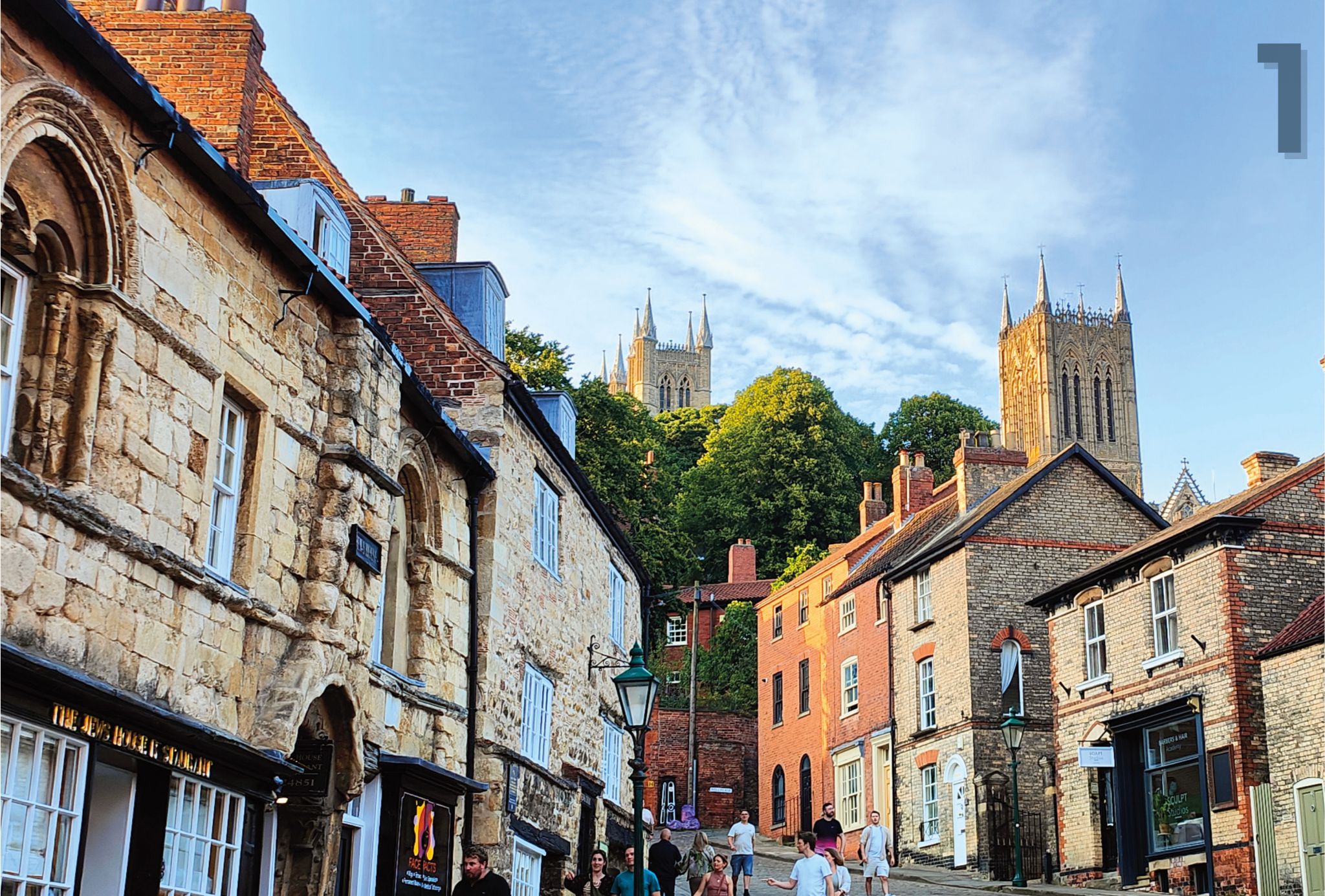
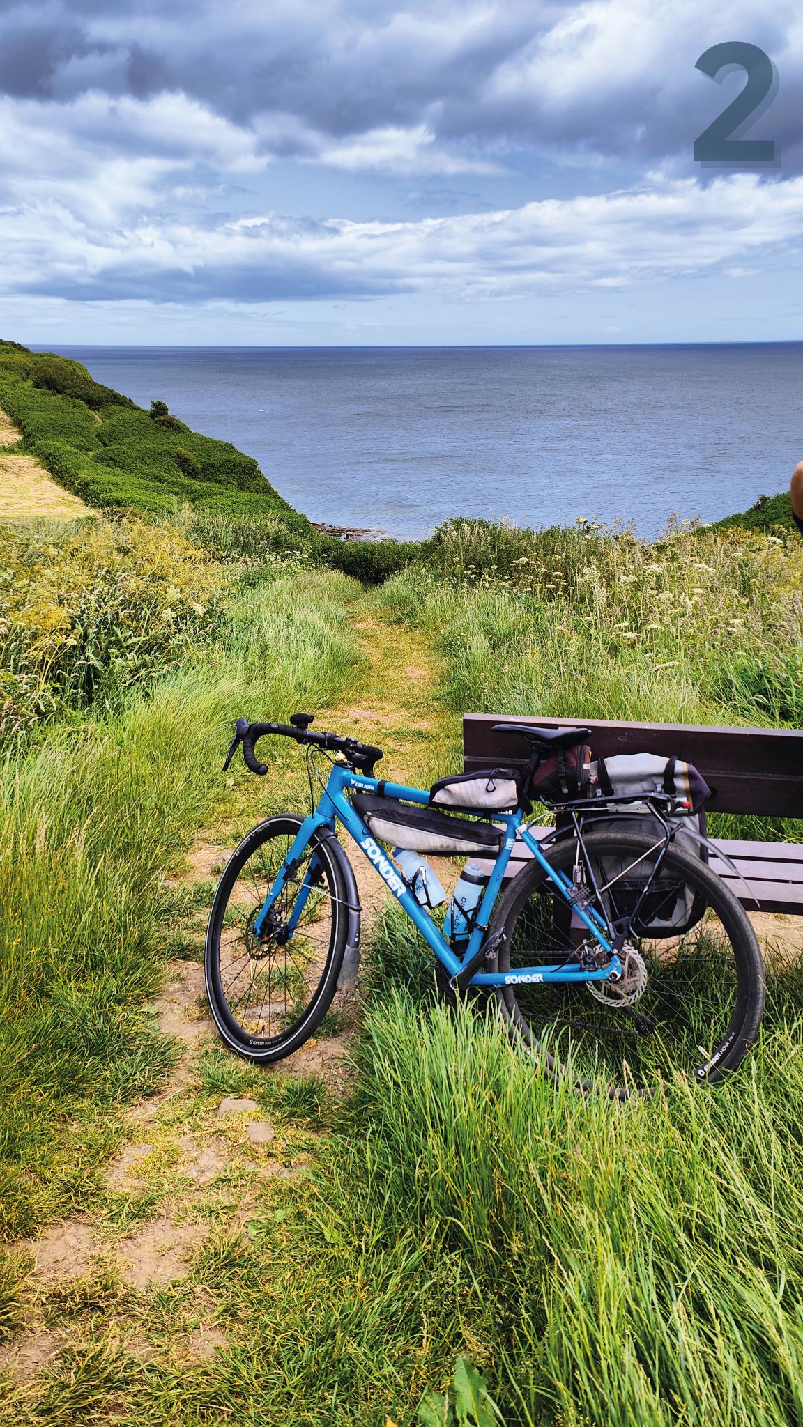
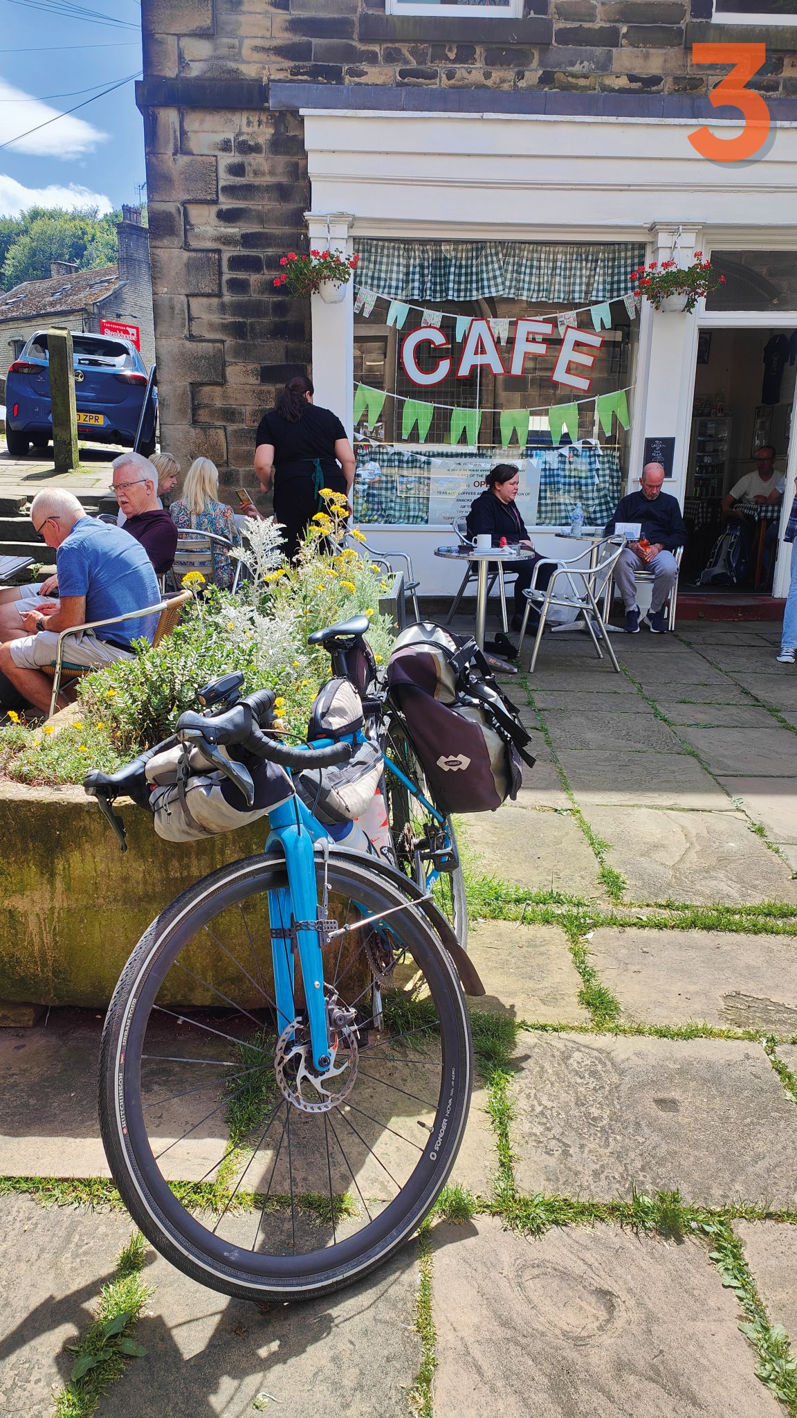
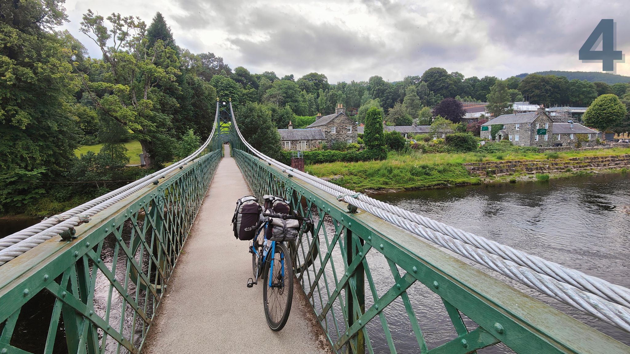
1. East, day one: Lincoln’s historic Steep Hill; 2. NE, day two: coastal extremity at Cloughton, near Scarborough; 3. NNW, day one: Sid’s Café, of Last of the Summer Wine fame, in Holmfirth; 4. NNW, day four: footbridge over the River Tummel in Pitlochry in Perth and Kinross, Scotland
Both come in at about 700 miles. Well, they do on paper. But cycling isn’t generally done on paper and straight lines don’t often lend themselves to convenient, traffic-free cycling.
Once I had these two longest lines – and four coastal destinations– in place, the rest more or less selected themselves. North to south (Beadnell to Barton-on-Sea) and west to east (Holyhead to Sutton-on-Sea) were easily and accurately fixed by following the grid lines on OS maps.
The others were chosen by directly linking together places that made the best opposing end points (for which just a little angular licence was permitted).
I was pleased that my line WNW sliced right across the Isle of Man and on through Belfast to end at Derry/Londonderry, a journey which could all be seamlessly linked together by ferries. The opposing ESE end point is Sizewell nuclear power station on the Suffolk coast, a huge, hulking golf-ball-shaped full-stop.
A SSW to NNE line ran from Beer in East Devon to Saltburn-on-Sea, while my WSW to ENE line linked Tenby with Flamborough Head, near Bridlington. As well as being beautiful, these were all definite, end-of-the-road places – in the nicest possible way.
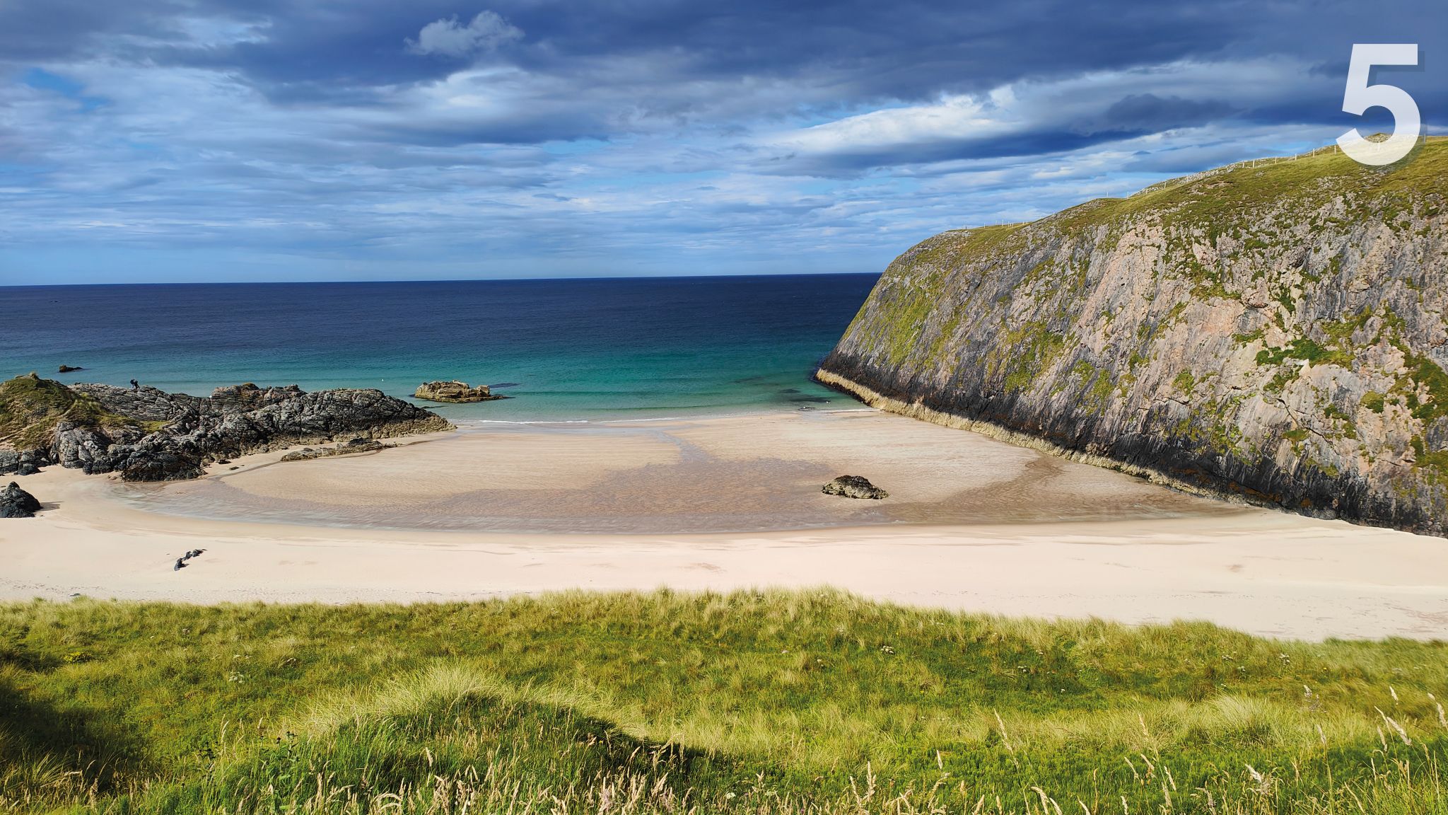
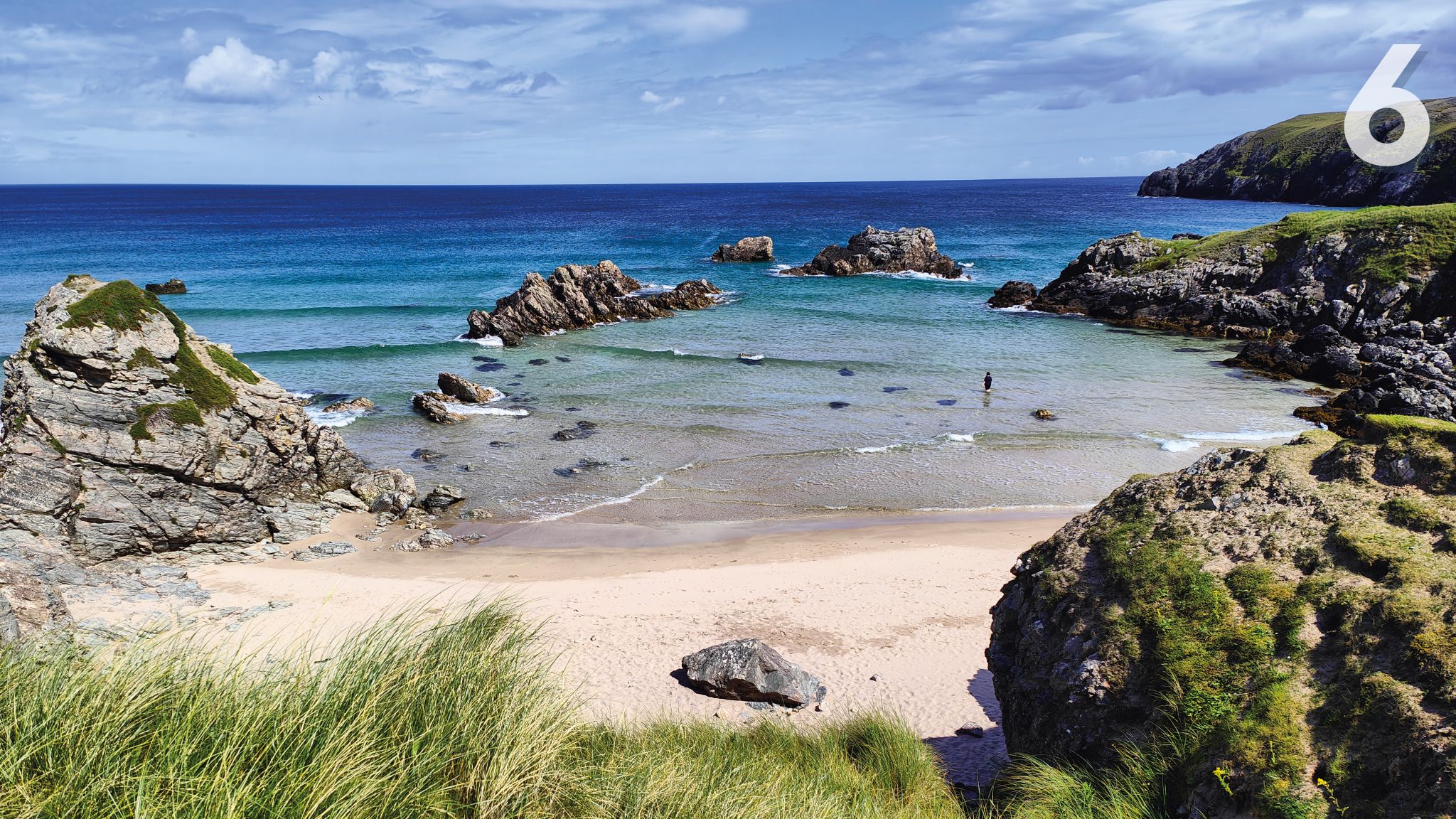
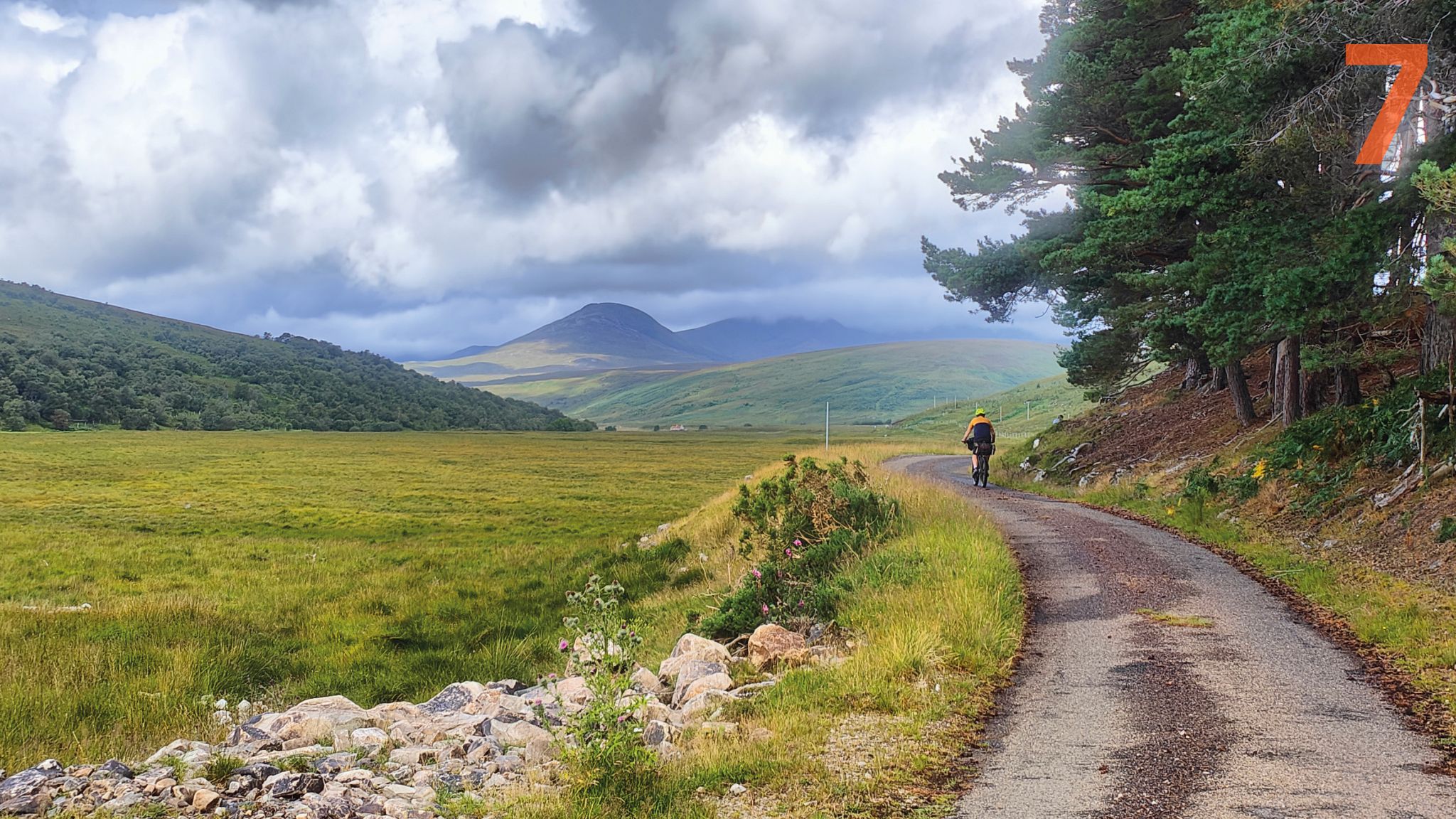
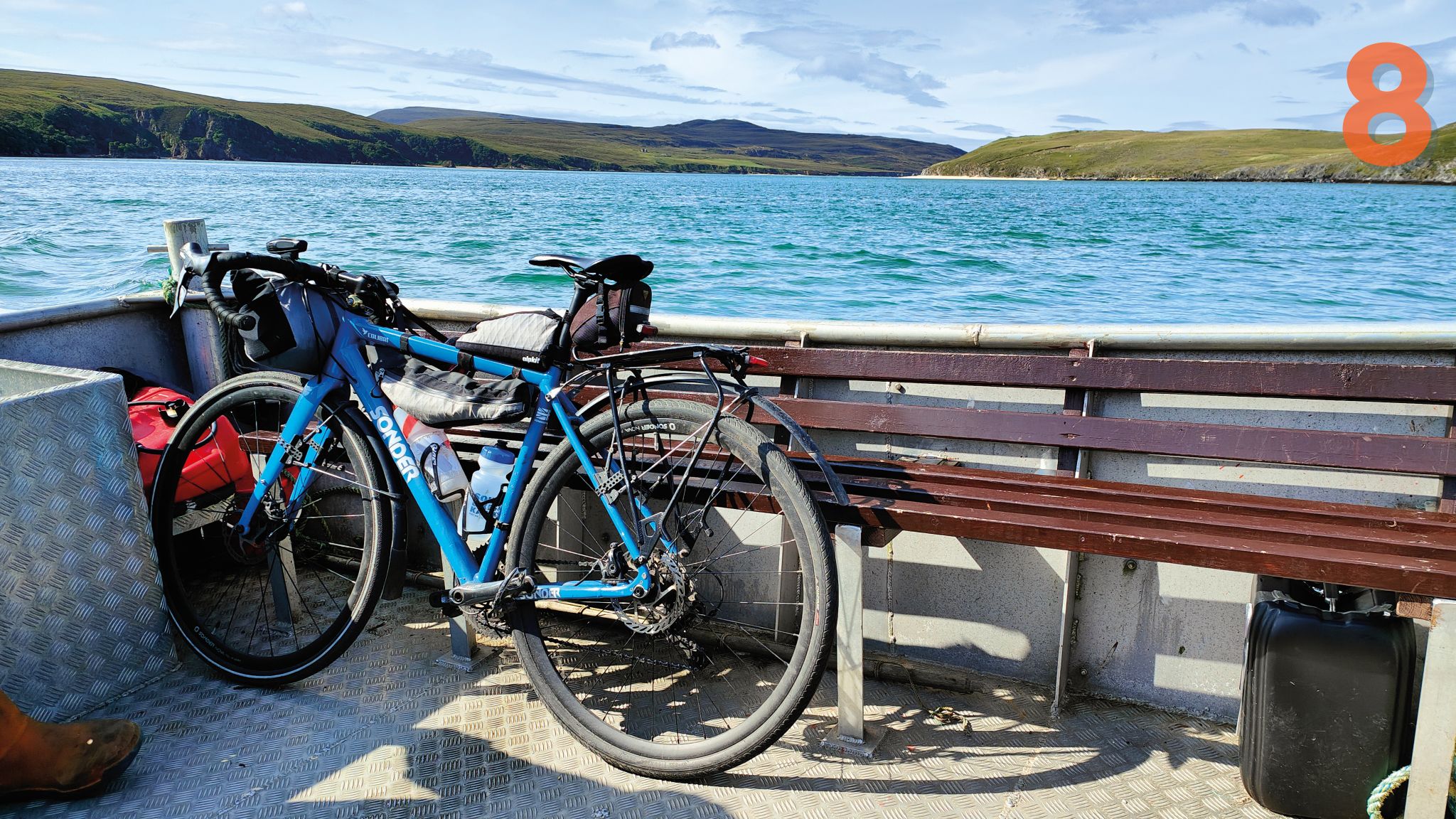
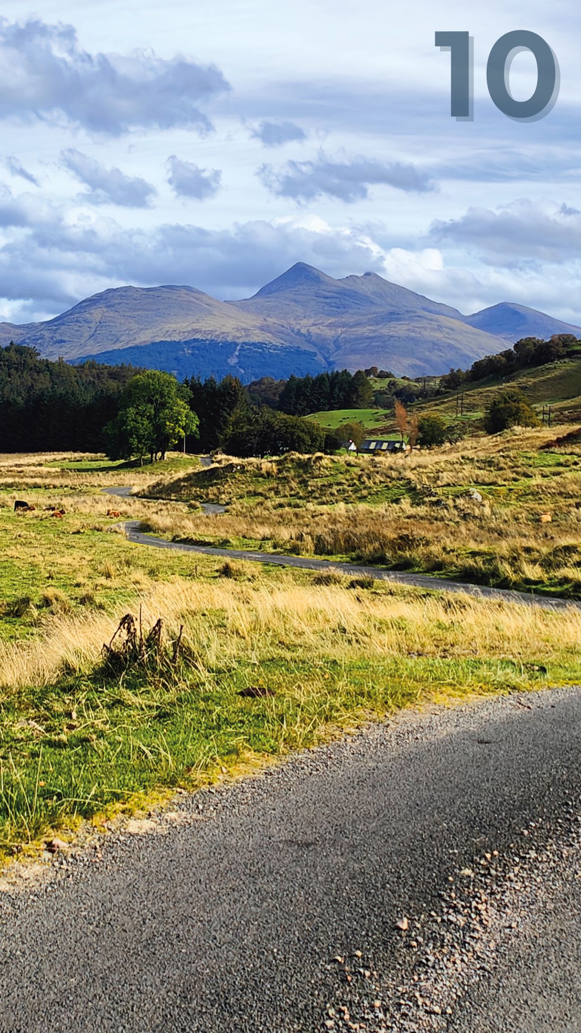
5. NNW, day seven: beach at Durness, near the north-western tip of Scotland; 6. NNW, day seven: beach near the village of Durness, where Mark stayed the night; 7. NNW, day seven: near Invercassley in the Scottish Highlands; 8. NNW, day eight: aboard the little Cape Wrath ferry, crossing the Kyle of Durness
Charting courses
These extremities, I felt, needed to be joined together – along with whatever unlikely and unsung places lay in between. They might not all be obvious choices to visit but I had found the perfect excuse for seeing them. And that is a wonderful thing in a country where surprises wait around every turn.
Even the most mundane places have the capacity to serve up something memorable, if you bother to look. It might be an exciting new bridge to cross, or a castle, or a church, or a café on a small airfield. The whole thing would take over 4,000 miles and five months of sporadically consistent cycling.
I decided I should find the best and most enjoyable cycling routes I could while remaining faithful to the direct spirit of my quest. The journeys that unfolded at ground level might be a bit wiggly but the bird’s eye view would be unmistakably compass-like.
My final (and first) line, from SW to NE, ran from The Lizard in Cornwall to Cloughton, a point just above Scarborough on the Yorkshire Coast. And that gave me a problem: how to cross the broad expanse of the Bristol Channel.
Luckily, once a year, PS Waverley – the world’s only functioning ocean-going paddle steamer – makes the crossing from Porthcawl in South Wales to Ilfracombe in Devon. It was a chance not to miss and it fitted my route perfectly.
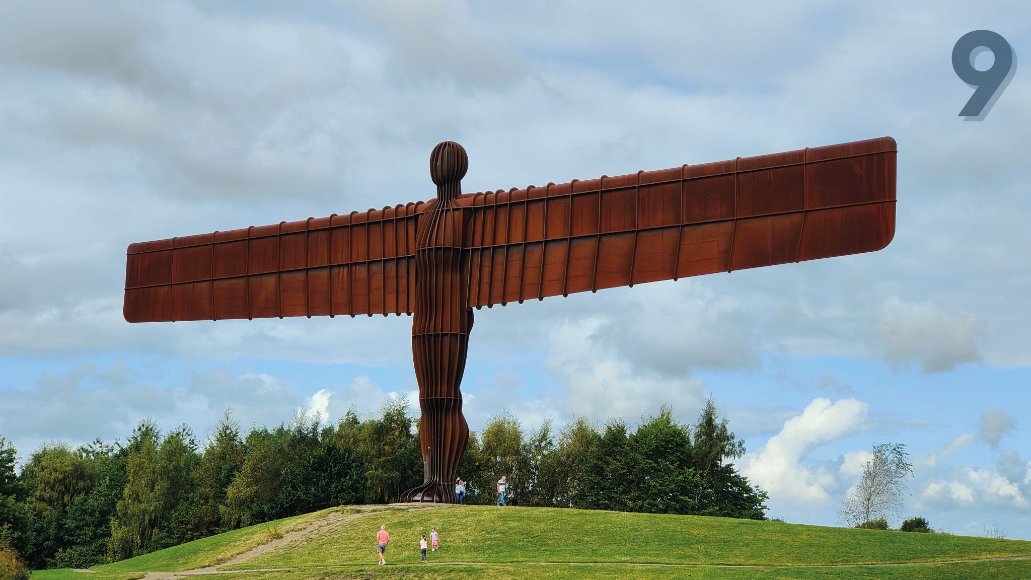
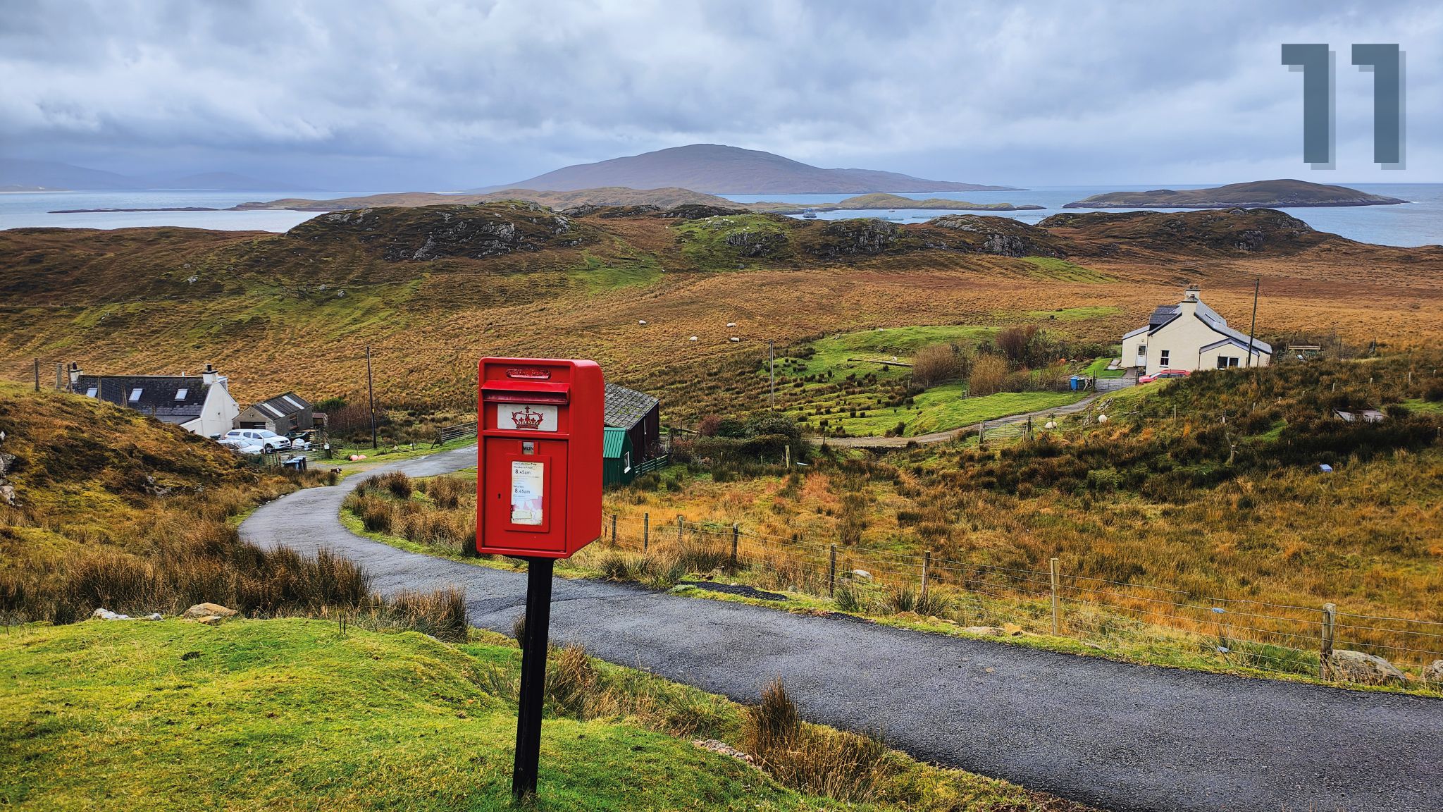
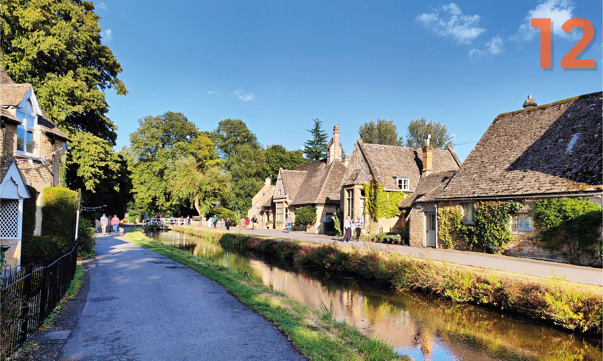
9. North, day three: Antony Gormley’s Angel of the North in Gateshead; 10. NW, day six: approaching Ben Cruachan, one of the Munros, a 1,127m-high mountain in Argyll and Bute; 11. Day nine of what was the longest leg, the NW bearing: Harris in the Outer Hebrides, which Mark reached in November; 12. South, day two: Lower Slaughter in the Cotswolds
I needed to leave home in time to be on her polished decks on 9 June. Thus dictated by fate, I left home on a drizzly June morning heading to Ironbridge in Shropshire, my first stepping stone in this multi-legged adventure of diverse parts.
I had agreed one other special feature to make this adventure more inclusive and, in turn, more of a voyage of discovery. The trouble with journeys that follow lines for many miles is that you are constantly on the move, and rarely spend as much time as you would like in the places you pass through. This adventure would be different.
My wife Jenni and I resolved to choose places along my 16 spokes where we would meet and have a full day off together, properly exploring a new town or city. Ironbridge in the Severn Gorge – 80 conspicuously hilly miles from home – was the first of these delightful stops.
Finding my bearings
So began five months of exploring the UK by bike in a whole new way. It was, almost without exception, a delight.
In a year when the British weather was getting bad press, I believe I got wet just four times. Admittedly the first occasion, in Cornwall, was a spectacular drenching before I had even reached the coast once, so I bailed for the day (almost literally).
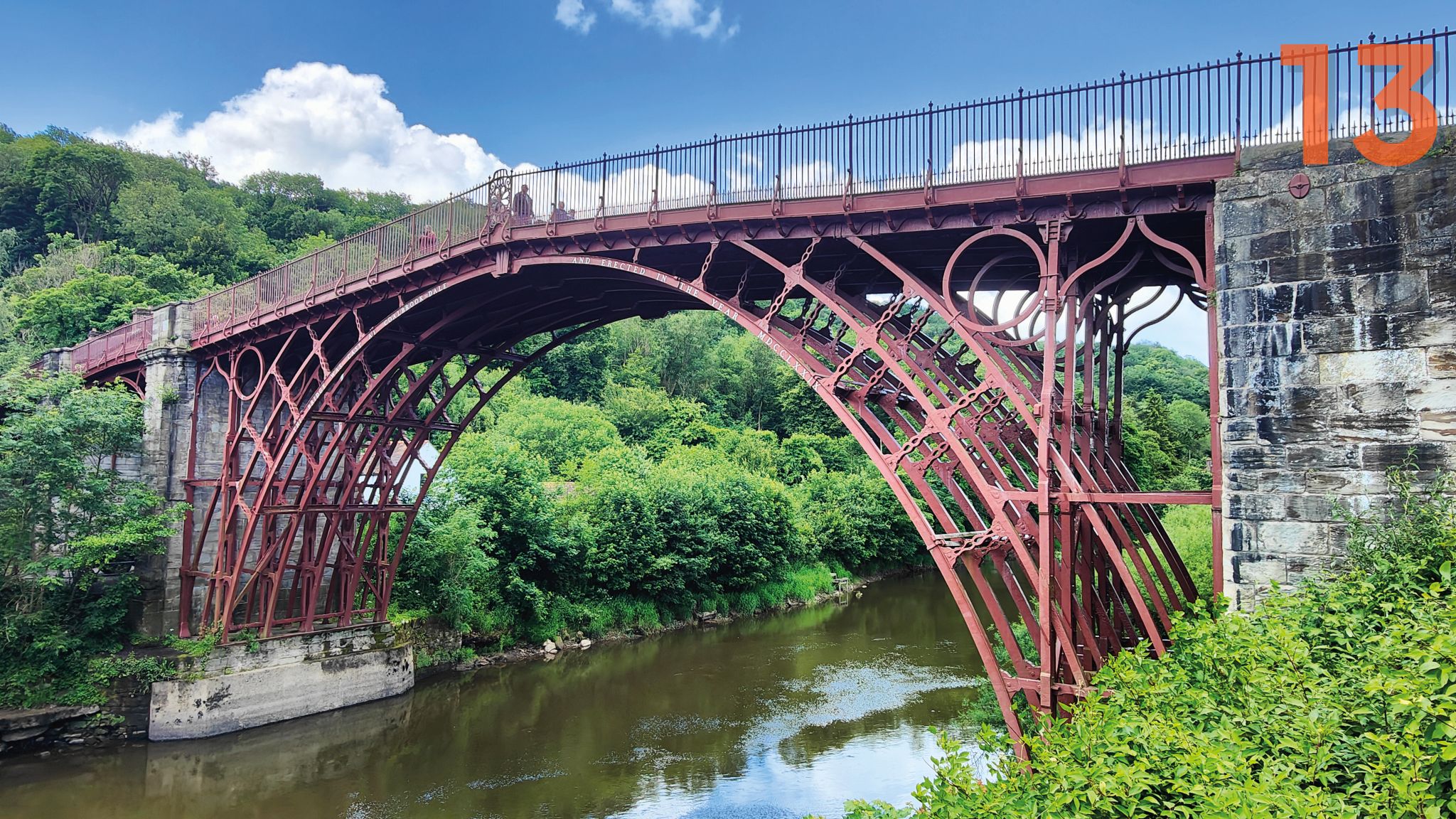
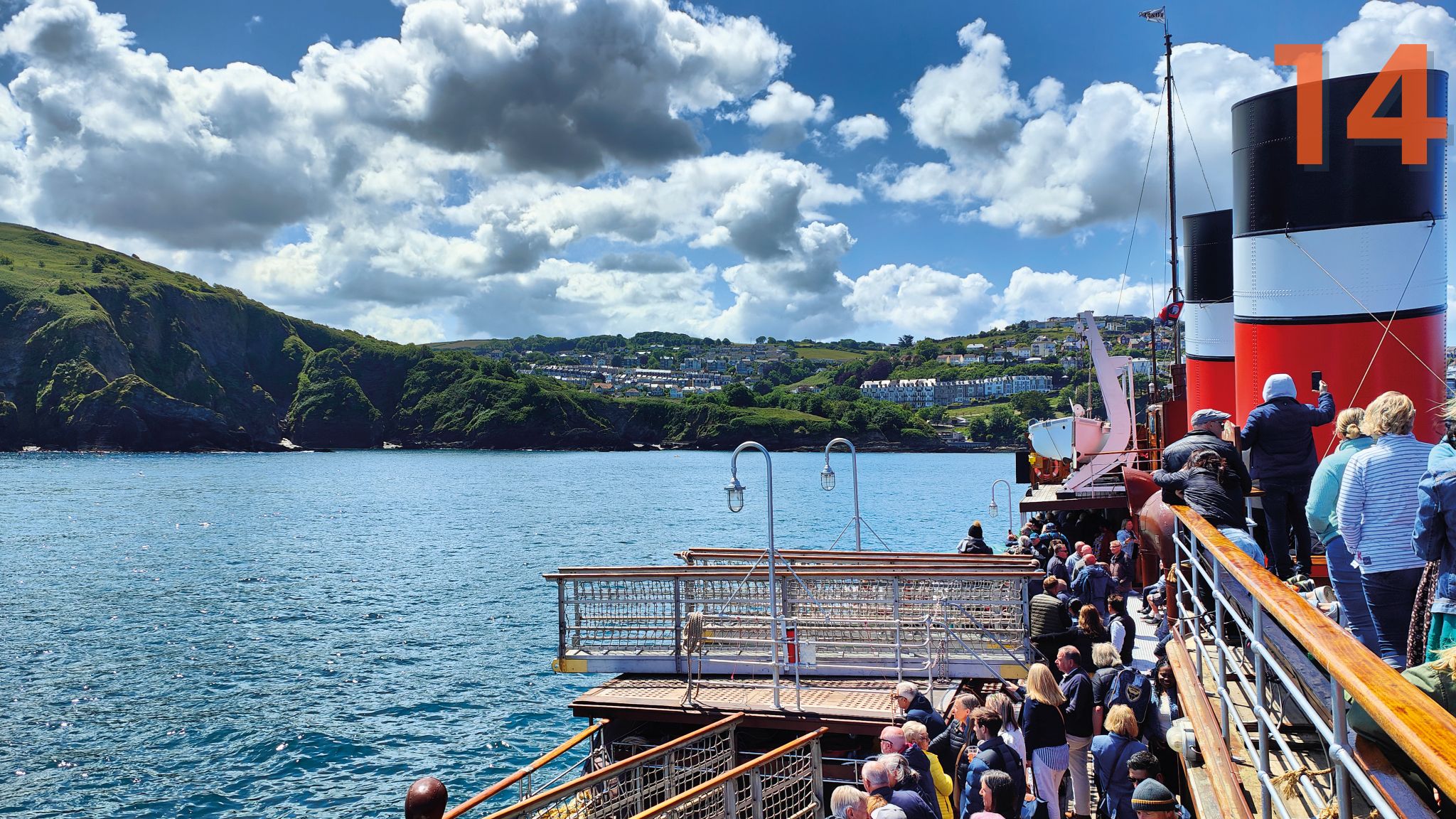
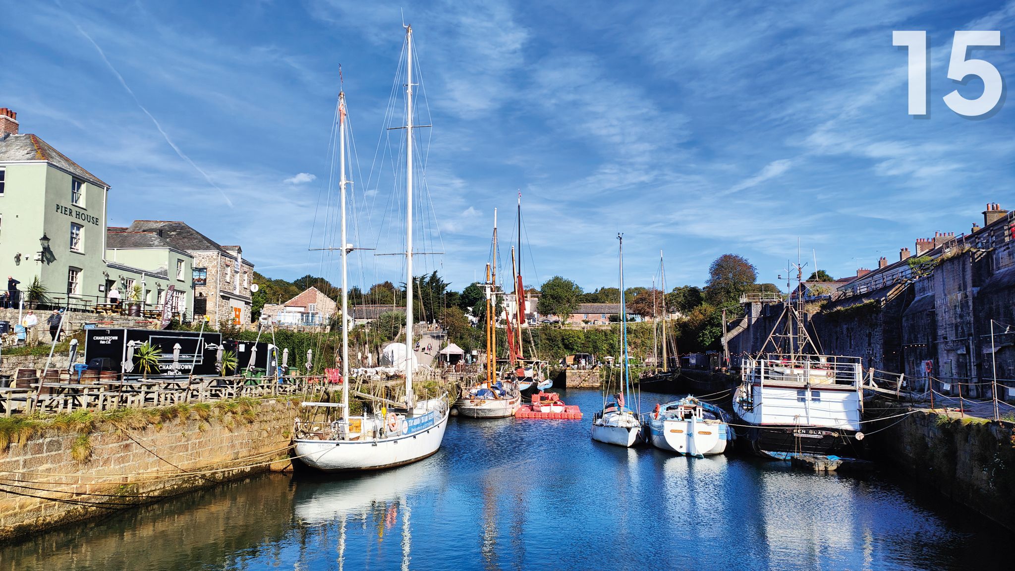
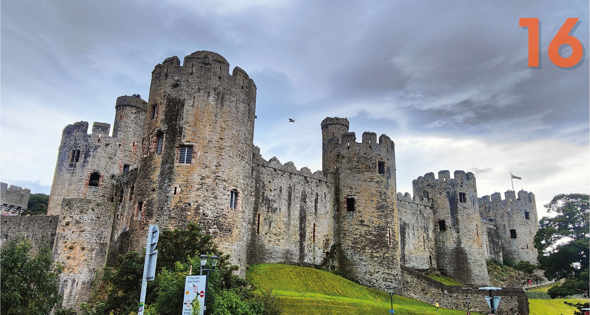
13. Day one while heading SW: Ironbridge, which is also part of Marcher Castles Way; 14. SW, day three: approaching Ilfracombe in Devon on PS Waverley, an historic paddle steamer that makes a once-a-year journey from Porthcawl in South Wales; 15. SW, day five: Charlestown harbour on the Cornish coast; 16. West, day two: Conwy Castle on the North Wales coast
Atlantic storms and cycling don’t mix, and I have a rule I always abide by: if it isn’t fun, I stop. Otherwise I enjoyed many weeks of wonderful cycling weather and beautiful, quiet cycling through mostly very pretty, and sometimes quite stunning, countryside. I was rarely disappointed and often thrilled.
The first part of any ride away from my house was often the trickiest. As the months went by, it got harder to find suitable routes from home that I hadn’t already used.
Like spokes on a wheel, the further I got from the middle, the more distance I put between the different rides. But when you live in rugged country like I do, keeping your lines apart close to home is difficult. Often the best routes available would also be fiendishly hilly on day one.
On a few occasions, I rode out on a sunny afternoon to get such an early section out of the way, then got a train home from somewhere about an hour’s train ride away, returning to resume my journey after sleeping in my own bed. This helped keep the costs down and took me on some unlikely train journeys.
On other nights, further from home, I stayed in pubs and hostels, or with friends and relatives, to keep the weight down and provide some well-earned comfort at the end of a long day of pedalling.
Points of interest
To keep life from getting too predictable, I made a spinner: a red cardboard arrow pinned to the centre of a circle divided into 16 equal segments.
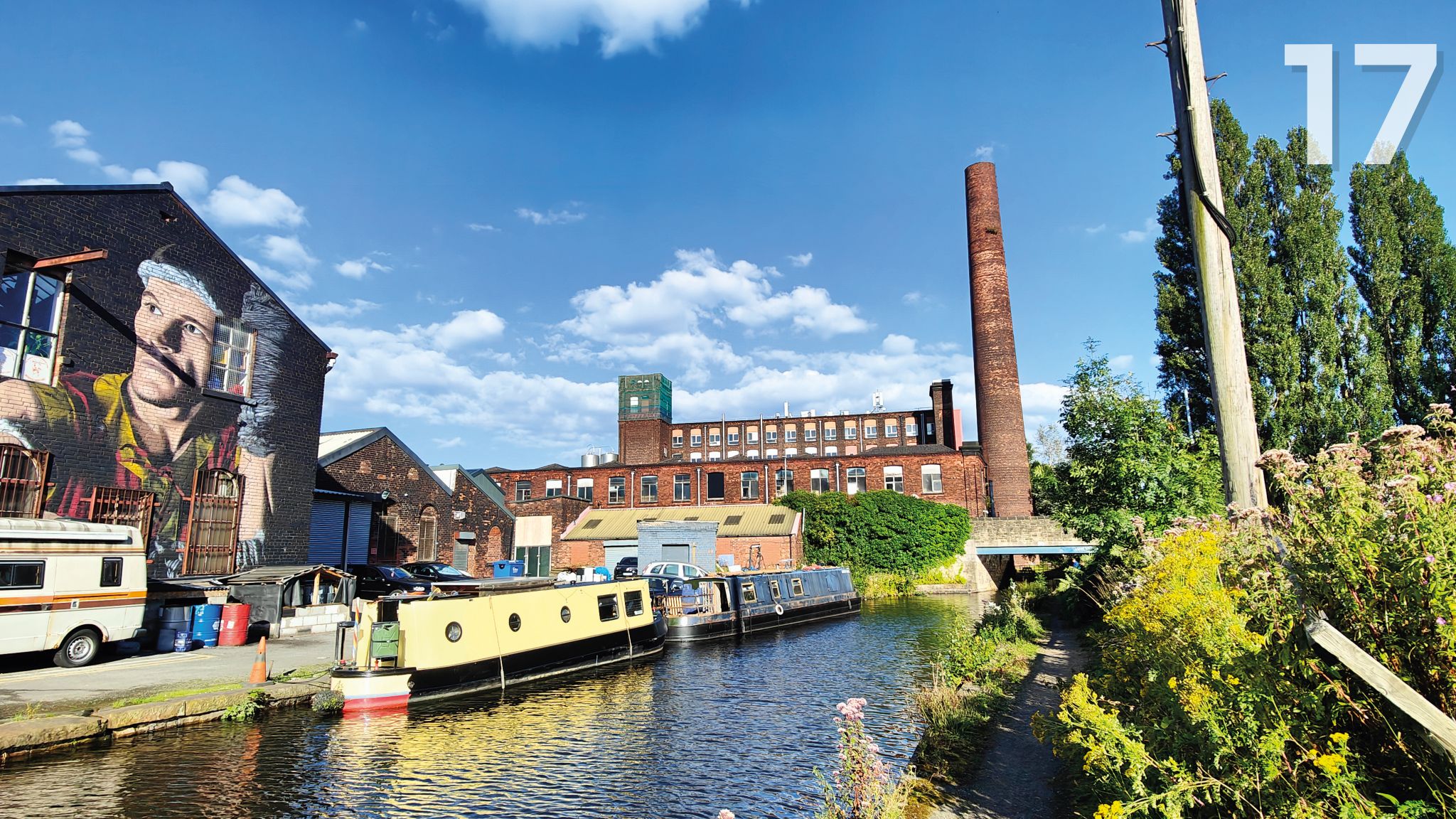
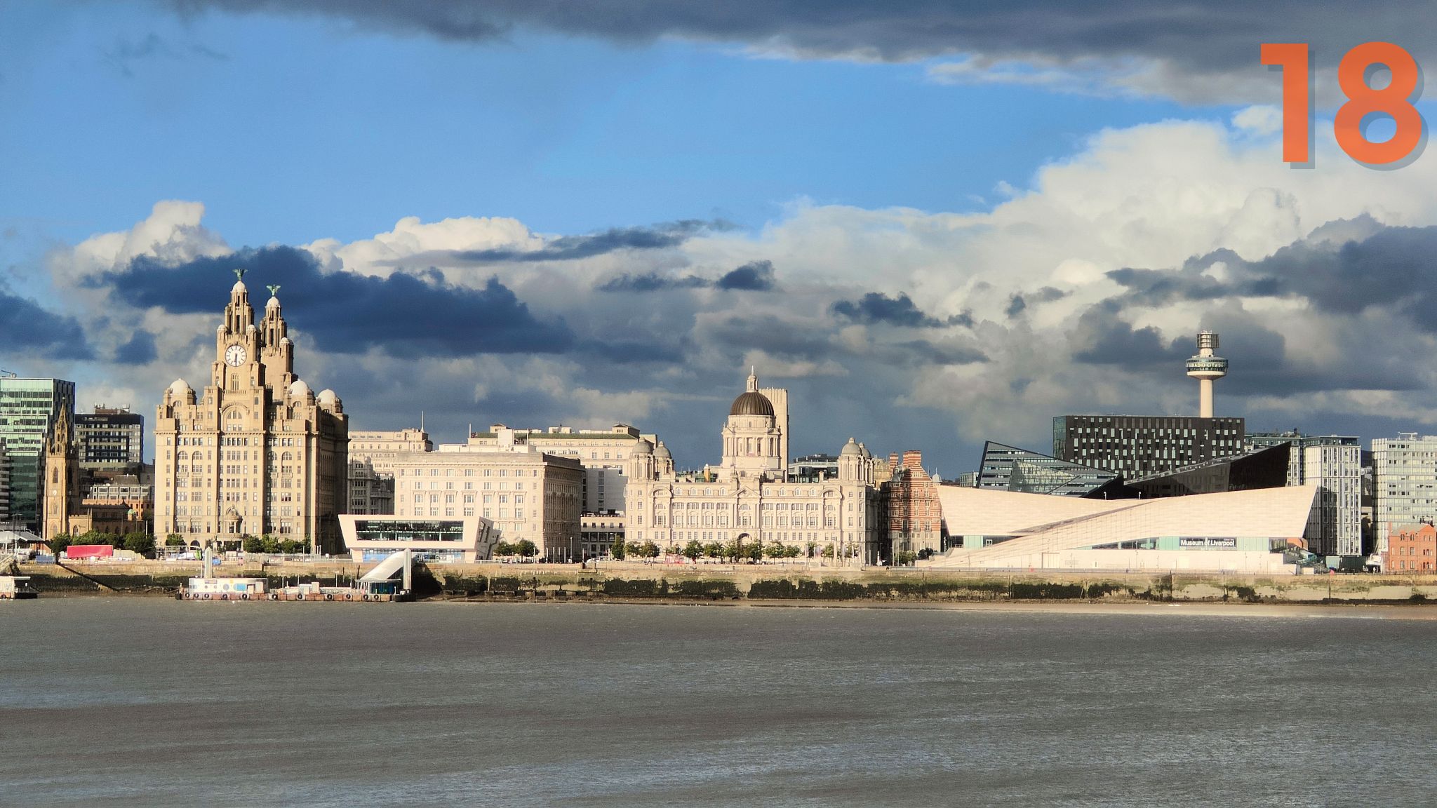
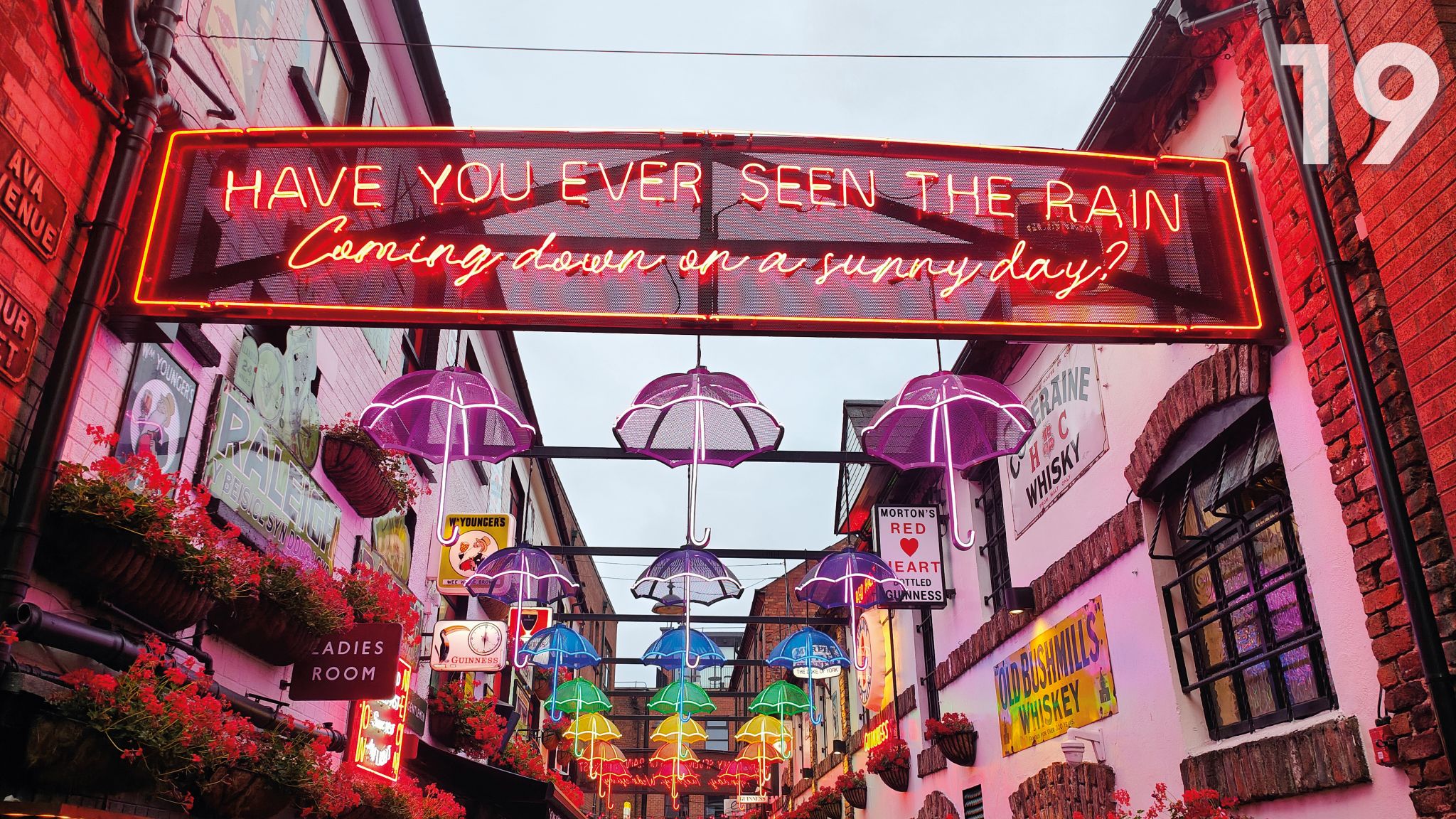
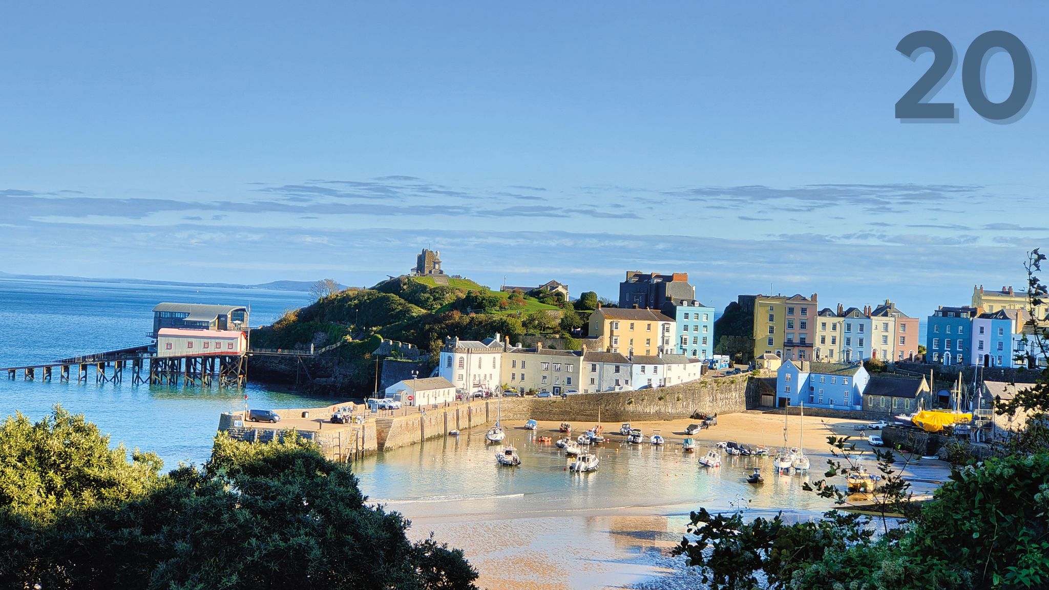
17. WNW, day one: Ashton Canal towpath, Greater Manchester; 18. WNW, day three: looking across to Liverpool from Birkenhead; 19. WNW, day five: Umbrella Street in Belfast, Northern Ireland; 20. WSW, day four: the seaside town of Tenby in Pembrokeshire
I would spin it to determine my next direction, unless I had a compelling reason to choose one direction in particular (such as catching a paddle steamer or, another time, attending the Hampton Court Flower Show in London with Jenni).
On two occasions I had company for a couple of days, which made a pleasant change to my usual solitary riding. But I was comfortable in my own company for most of each day, taking each ride as it came.
Despite my previous cycling adventure across every OS map of Britain in 2022, there was still a great deal to discover for the first time, and even more to see for the first time in ages. It never once got boring or predictable. There really is so much to enjoy in this country if you are curious, and especially if you avoid the crowds.
A long and well-planned journey can be very rewarding, but I learned this time that it is worth taking time out to get to know somewhere better. We met, paused and explored for a day in destinations we would probably not otherwise have given close attention.
The likes of Chester, Durham, Lincoln, Ironbridge, Shrewsbury, Belfast and Skipton made for some memorable times together, proving you don’t even need to get on a bike to be part of a cycling adventure. It made me more curious to properly explore more of Britain’s towns and cities.
We had some fabulous meals, stayed in some lovely accommodation and saw rich examples of our long and colourful history. It was time and money well spent. After which, I got back on my bike and carried on riding in a straight line!
Fact file: Cardinal spins
Distance: about 4,150 miles in total, with 66 days of cycling, so a daily average of 63 miles. Total ascent 239,635 feet.
Route: From my home in the Peak District to each of 16 coastal extremities, following straight lines towards each point of the compass, avoiding busy roads.
Longest & shortest: Longest leg was NW: 592 miles. Shortest was east: 127 miles.
Conditions: Quiet roads and country lanes. Some towpaths, rail trails and cycle paths. Occasional main roads.
Bike used: Mostly my Sonder Colibri AL but also a Rose Pro SL road bike and a Specialized Tricross.
Maps/guides: For route planning I used paper OS maps of various scales – including road atlases for drawing long, straight lines. I had OS Maps on my phone for navigation.
I’m glad I had… Applied chamois butter every morning before I cycled! I also used a fair amount of sun cream.
Next time I would… Start before June. I hadn’t intended to end my adventure in the Outer Hebrides in early November.
Further information: Mark’s website is ridealltheosmaps.co.uk, and he’s on Instagram at @boringtodull.
Pedant’s note: Mark actually rode the cardinal, ordinal and secondary intercardinal directions from his home. But that would have made an awkward title!
Magnetic attractions
The cycling encompassed too many highlights to list in full. A few of my favourite days included:
- Riding NNW from Skipton along Upper Wharfedale, up and over to Hawes in Wensleydale, then on to Kirkby Stephen and Appleby. After that, tracking along the west side of the North Pennines as far as Brampton.
- Riding from Settle in North Yorkshire, NW via Ingleton and Kingsdale to Dentdale, and then through Sedbergh to skirt the west side of the Howgills range, along the Lune Gorge and right up to Shap. And then along the lovely Lowther Valley and over via Pooley Bridge to Penruddock, in the shadow of Blencathra.
- Taking a late afternoon ferry across the Firth of Clyde to Dunoon and then cycling all along loch sides to reach Inveraray, on the far side of Loch Fyne, at sunset. Sublime.
- Cycling along the SW coast of Cornwall, stopping for breakfast amid tall ships in the World Heritage harbour at Charlestown, then on along the Roseland Peninsula to pretty St Mawes, and then by ferry over Carrick Roads to Falmouth, and past beautiful beach-studded coastline, via Helford Passage ferry, to the tip of the Lizard, Britain’s most SW point. A visual feast.
- NNE over the purple-carpeted North York Moors from delightful Helmsley to Saltburn Pier.


