Gallovidian Gravel: your questions answered

- How do I get there and back, and can I leave my car for a few days?
- Can I take my bike on the train to start the route?
- How long does it take to ride the route?
- What is a GPX file? How do I use it?
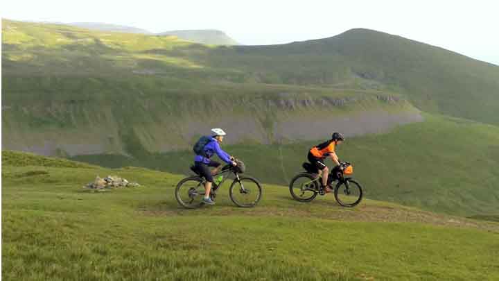
- Which kind of bike is best?
- What kind of kit should I take?
- Is there somewhere I can hire a bike?
- Is there a printed guidebook available?
- How difficult is it? What’s the terrain like?
- Is there information about accommodation and facilities along the way?
- Can I ride it in either direction?
- Is the route signposted?
How do I get there and back, and can I leave my car for a few days?
Dumfries is well served by a train station, using ScotsRail or Avanti West Coast Service and can be accessed from many points across the UK. There is also a ferry from Northern Ireland into Stranraer, you can then access the route either by cycle or car from the ferry terminal.
Dumfries is easily accessed by car. It’s a relatively short, 40-minute drive from the M6 motorway.
There is parking available in Dumfries for extended stays, platforms such as JustPark provide details of spaces available and how to book.
Can I take my bike on the train to start the route?
Yes. Booking is required, check with train operators for booking process and availability.
How long does it take to ride the route?
This will depend on several circumstances: weather, fitness, speed and so on. We have designed the route to be ridden over a long weekend. Within the guidebook we have provided a range of itineraries to complete the route.
What is a GPX file? How do I use it?
A GPX file is a standardised, open-source XML file format used to store and exchange location data, such as waypoints, tracks and routes. To use one you’ll need a device such as a bike (Garmin, Wahoo, etc) computer or a smartphone with a free app such as Strava.
You can download a GPX file of the Gallovidian Gravel for free.
Which bike is best?
As the name suggests, a gravel bike is best suited, however a robust touring bike with some treaded tyres would work in the dryer months. This route doesn’t require a mountain bike, although a hardtail mountain bike could be used; we’d advise against a full suspension mountain bike.
What kind of kit should I take?
This will depend on forecasted weather, planned itinerary, choice of accommodation: camping, wild camping, hotels, B&Bs or some combination.
The remoteness of some sections of this route and the mountainous landscape can mean weather can change quickly and unexpectedly, we’d therefore recommend warm and waterproof clothing even in the summer. Being Scotland, midges can be present from May through to September.
Is there somewhere I can hire a bike?
There are several bike hire businesses in Dumfries and Galloway that provide cycle hire; check with local providers for availability, suitability of cycles and multiday hire options.
Is there a printed guidebook available?
Yes, available from our online shop.
How difficult is it? What’s the terrain like?
The terrain is best described as rolling hills rather than very steep inclines; the route mainly utilises surfaced National Cycle Network routes, quiet back lanes and forest gravel tracks, meaning that the surfaces are relatively easy going for an Adventure Series route.
The difficulty will come from the length, at 330km, and remoteness at times of the route.
Is there information about accommodation and facilities along the way?
Yes, this can be found in the accompanying guidebook and the GPX will highlight the towns and villages that the route passes through.
Can I ride it in either direction?
Yes, but we’ve designed the route to work better in the direction suggested.
Is the route signposted?
No. However, it utilises the National Cycle Network and the Kirkpatrick MacMillan C2C route, so elements are signed but we advise using the official GPX and excellent guidebook, available from the Cycling UK Shop.
Gallovidian Gravel route guide and art print
Discover our official guidebooks and art prints, created to help you plan, enjoy and celebrate your cycling adventures.
Our guidebooks feature detailed maps, local highlights and practical advice – everything you need for an unforgettable ride. The official A3 art prints, designed with Ordnance Survey and printed on premium heavyweight paper, are perfect for commemorating a ride well done or inspiring your next one.
Buying these contributes to Cycling UK’s vital work in improving cycling for everyone and allows us to create more great routes for you to enjoy.
The Gallovidian Gravel guidebook and art print are available now. Plus buy any guidebook and receive £6.99 off a poster, applicable across all guidebook and poster combinations. Discount automatically applied at checkout.