King Alfred’s Way FAQs

If you have a question that isn’t answered here, please get in touch with us and we can add it to the list.
- How long does it take to ride the route?
- Can I just ride a section rather than the whole thing?
- Does it matter which way I ride the loop?
- Which kind of bike is best?
- How difficult is it? What’s the terrain like?
- Is it all off road?
- Is there information about accommodation and facilities along the way?
- Are there options for wild camping?
- I’ve ordered the printed guide – how long will it take to arrive?
- Is the route signposted?
- Do I need to have a GPS?
- How do I download the GPX file and transfer it to my phone or GPS device?
- Are there guided trips or luggage transfer available?
- Are there any safety issues I should be aware of?
- Can I walk it rather than cycle?
- Can I ride it with a child’s trailer?
- If I start and finish in Winchester, is there somewhere I can leave a car for a few days?
How long does it take to ride the route?
That depends on how far you’re used to riding in a day – if riding 115km/70 miles a day is no problem, you could complete the route in three days, but if you’d rather ride 50km/30 miles a day and have more time to stop off and look at all the interesting things along the way, then you’ll want a leisurely six days.
For many people, four or five days will be a happy medium. With so much to take in, it’s definitely not a route to rush.
At the back of the route guide we have suggested some itineraries with stopover points for two, three, four or five nights.
Can I just ride a section rather than the whole thing?
Because King Alfred’s Way passes through or close to Winchester, Salisbury, Swindon, Reading and Farnham, it works well for day rides if you don’t want to tackle the whole thing in one go.
You could do a linear route between train stations, or connect with nearby rights of way and cycle routes to create your own loop.
Does it matter which way round I ride the loop?
We recommend riding the route clockwise for two reasons.
Firstly, the route was planned with a clockwise direction in mind, so that where possible you have steady climbs and fun off-road descents.
Secondly, you’ll have less chance of a headwind – riding into the wind along the Ridgeway is pretty hard work.
Which kind of bike is best?
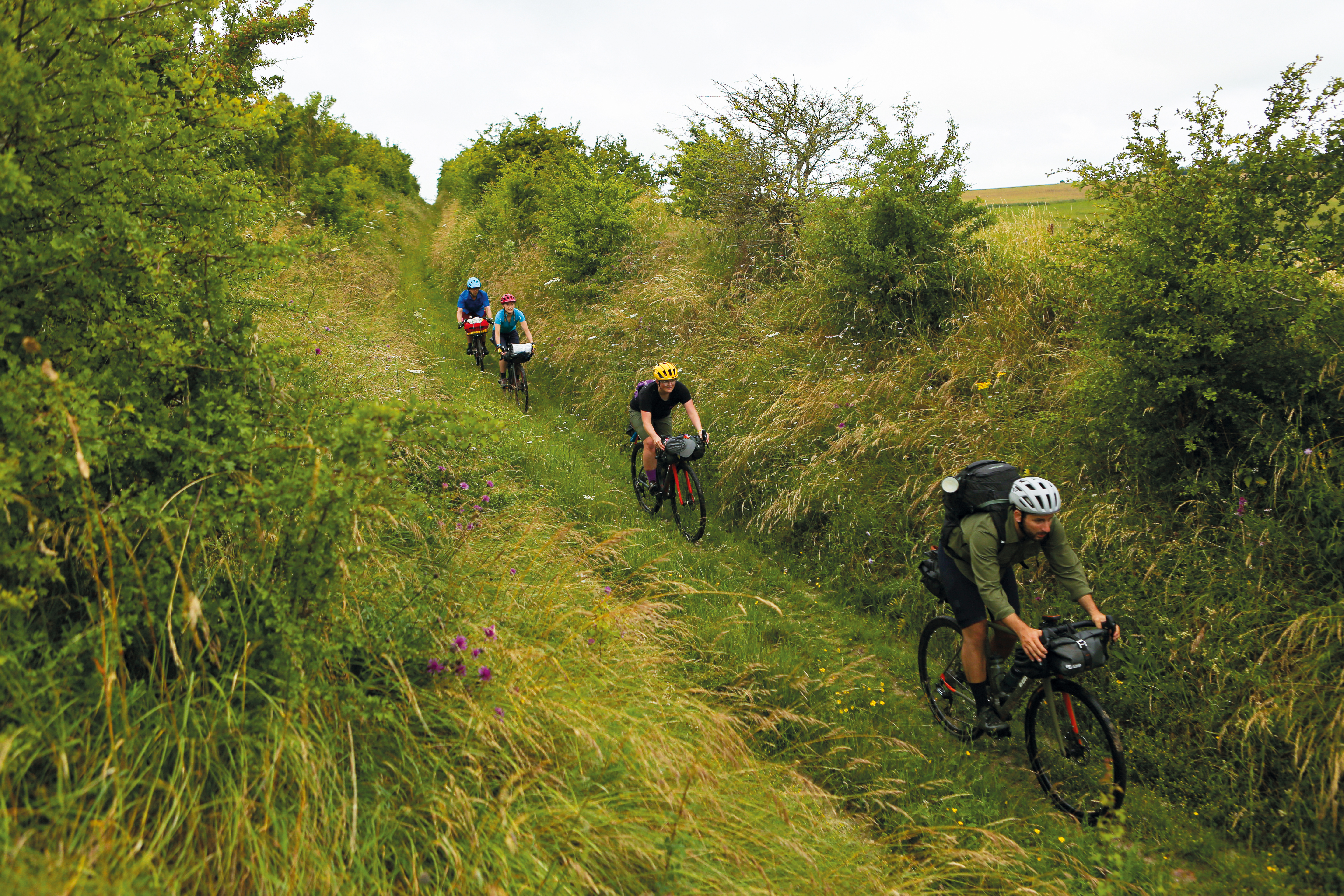
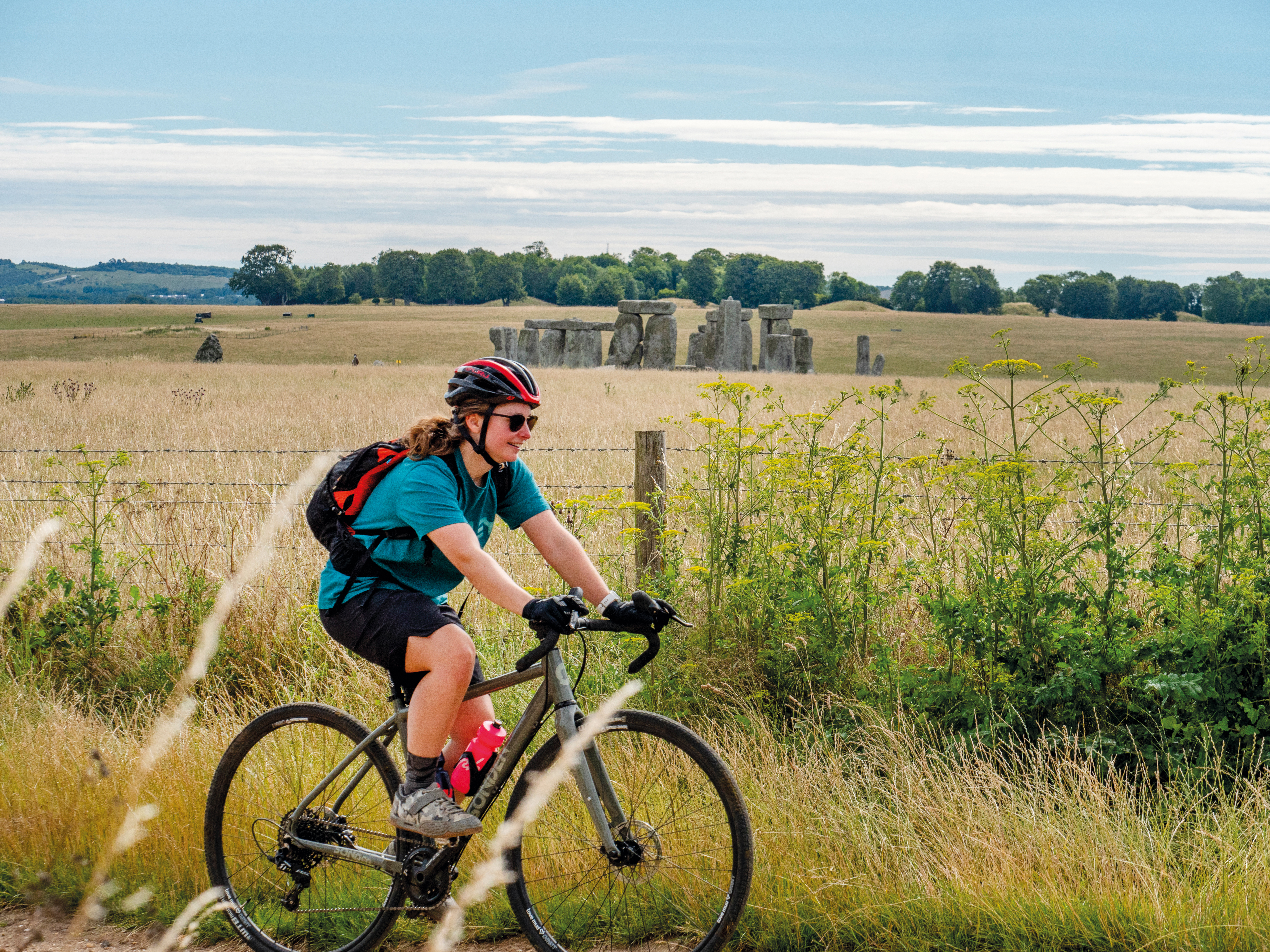
With a mix of gravel tracks, woodland trails, sandy heathland, canal towpaths and rural lanes, King Alfred’s Way is a perfect route for gravel bikes, especially in summer. A robust touring bike or hybrid with fairly wide tyres (>2") would be fine too. In the off season, wetter weather will mean more mud and some slippery chalk sections, where a mountain bike would provide more security.
If you are thinking of taking an e-bike, there are extended sections of the route where you will be away from convenient charging points, so plan/ration battery use accordingly. There are no points where you have to physically lift the bike, though.
Route guide author and professional MTB tester Guy Kesteven gives some more detailed advice on bikes and kit in this article and video.
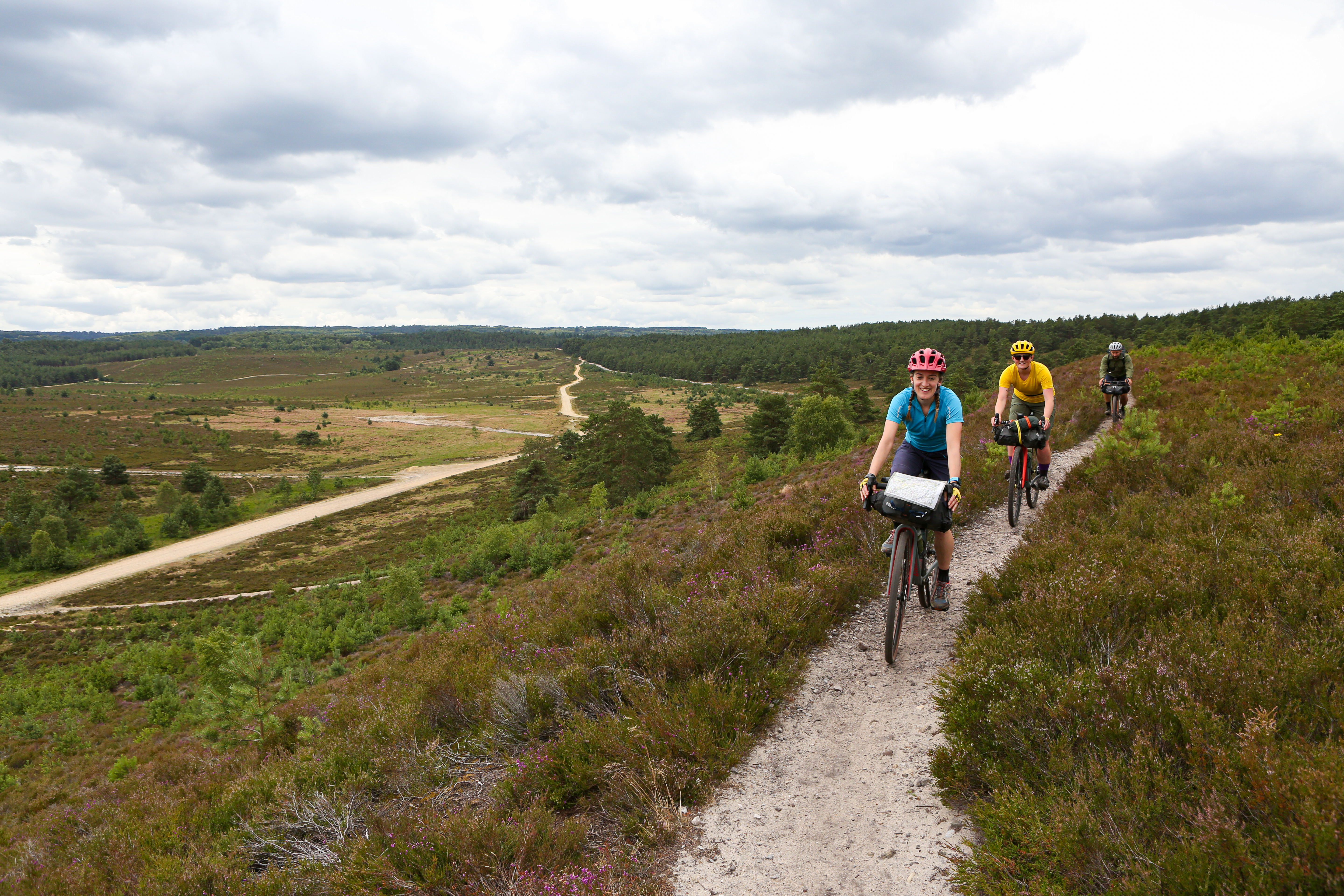
How difficult is it? What’s the terrain like?
King Alfred’s Way was designed as an ‘off-road adventure route’ for people with a decent level of fitness and some experience of riding off road on rough terrain, but not requiring technical mountain biking skills.
There is a real mix of terrain, including gravel tracks, woodland trails, grassy field edge bridleways, sandy heathland, rutted chalk byways, canal towpaths and quiet rural lanes.
There are some steep climbs and descents to watch out for and good stamina is required, but overall the route would be given a Blue difficulty grading (‘moderate’ – suitable for people with some experience of off-road cycling, with some loose surfaces, ruts and tree roots). There are a few options for diverting to more challenging MTB trails if you like, such as at Queen Elizabeth Country Park.
Of course, as it’s an off-road route, riding conditions, level of challenge and expected speed can vary significantly depending on current and preceding weather. Chalk surfaces in particular can become slippery when wet.
To get a sense of what the route is like to ride, have a look at Guy Kesteven’s excellent videos.
Is it all off road?
Depending which options you take, about 80-85% is on bridleways and byways, with the remainder on traffic-free routes and quiet roads.
Is there information about accommodation and facilities along the way?
At the back of the route guide, there is a table showing the facilities in each town or village close to the route to help you plan your trip.
Rough Ride Guide has also created this brilliant interactive map of places recommended by people who have ridden it.
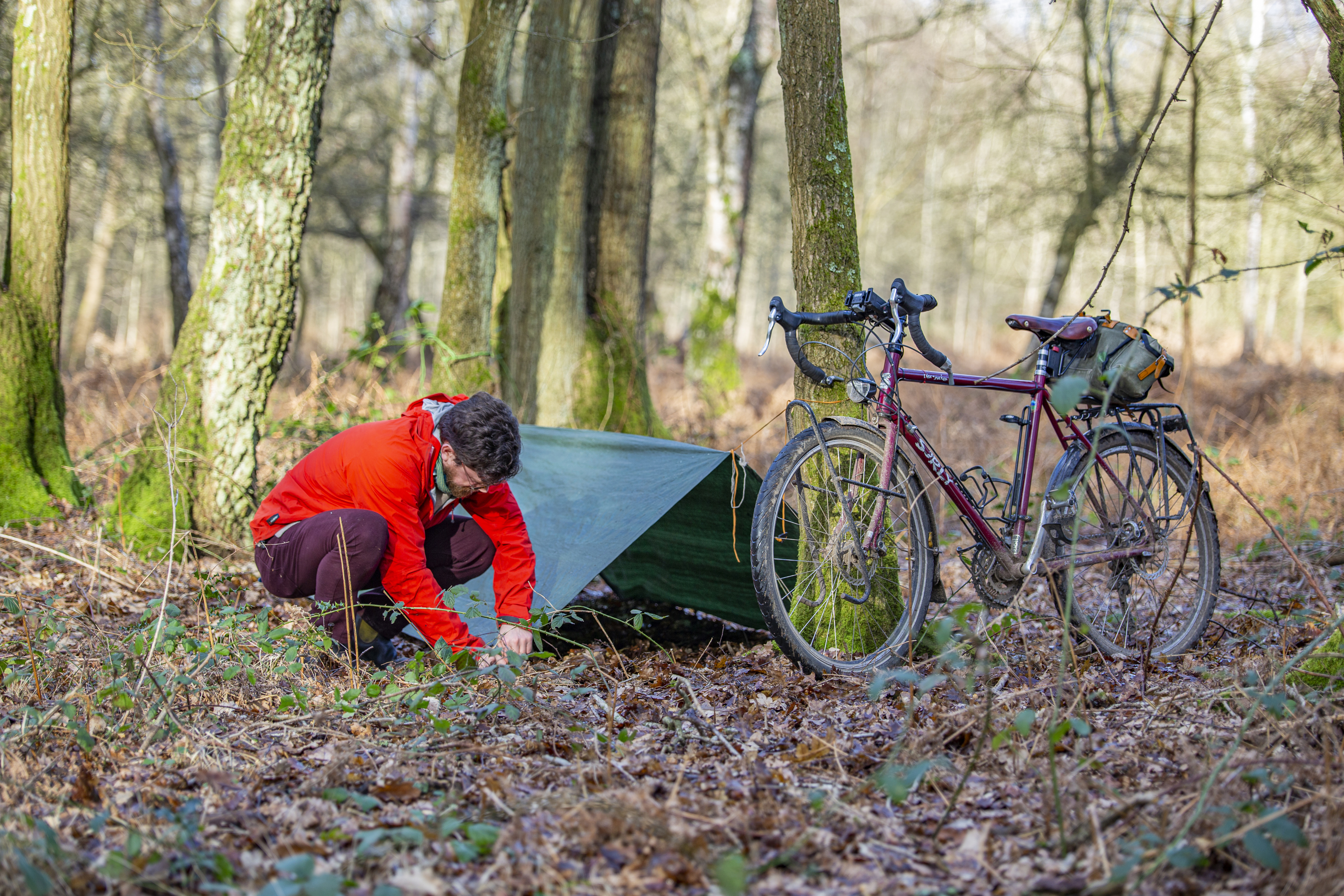
Are there options for wild camping?
There are several campsites available along the route, but if you prefer wild camping there are also plenty of options to find a bit of woodland or hedgerow to tuck yourself away into. The section from Reading through to Farnham is a bit more built up so potentially more tricky.
Bear in mind that in England, wild camping is only legal within Dartmoor National Park – so you should always ask permission from the landowner if possible, and move on if asked to do so. And remember the number one rule: leave no trace. There’s more advice on our wild camping page.
I’ve ordered the printed guide – how long will it take to arrive?
Due to the coronavirus pandemic, Cycling UK staff are still working from home and only occasionally going into the office, so please allow up to five working days for your order to be dispatched. We appreciate your patience.
Is the route signposted?
The King Alfred’s Way route itself is not signposted, but large sections of it follow existing waymarked routes including the Ridgeway, South Downs Way, Shipwrights Way and Sussex Border Path. However, there are other parts where you will need to pay more attention to navigation.
You can download the GPX file on the main route page, and the route is fully mapped at the back of the printed route guide.
Do I need to have a GPS?
The route is fully mapped at the back of the route guide, so it’s not essential to have GPS navigation if you prefer a paper map.
Some sections follow existing waymarked routes, making navigation quite simple, whereas other parts are a bit fiddly so be prepared for your progress to be a bit slower on those sections if you are map reading.
How do I download the GPX file and transfer it to my phone or GPS device?
There are links to download either the full route or sections of it on the main route page.
The easiest way to download the file to your phone is to navigate to this page using your phone, and then if you scroll down to the bottom there are links to download the gpx files.
If you want to view the route on a map, you will need a special app to do that, such as Viewranger, Komoot or Ride with GPS. There are quite a few different apps which are free to download with the option to pay for extra features like turn-by-turn navigation.
To use the route on a GPS device (Garmin, Wahoo and so on), depending on the age of your device you may need to download the GPX file to your computer, then plug your device into the computer, open the file explorer and drag the GPX file across to the relevant folder – directions will vary depending on the make of device you have.
For more modern devices like the Wahoo ELEMNT ROAM you should be able to link it to your phone, and if you have an online mapping account like Komoot, RidewithGPS or Strava send the route directly to your bike computer.
There are more details in our guide to GPS and route plotting for cyclists.
Are there guided trips or luggage transfer available?
King Alfred’s Way is still a fairly new route, but options for supported trips are starting to become available if you have a look around. Keep in mind that these organisations aren’t connected to Cycling UK and if you book, make sure it’s with a reputable company. The Cycling UK-affiliated Rough Ride Guide offers a four-day supported ride or a luggage transfer-only option.
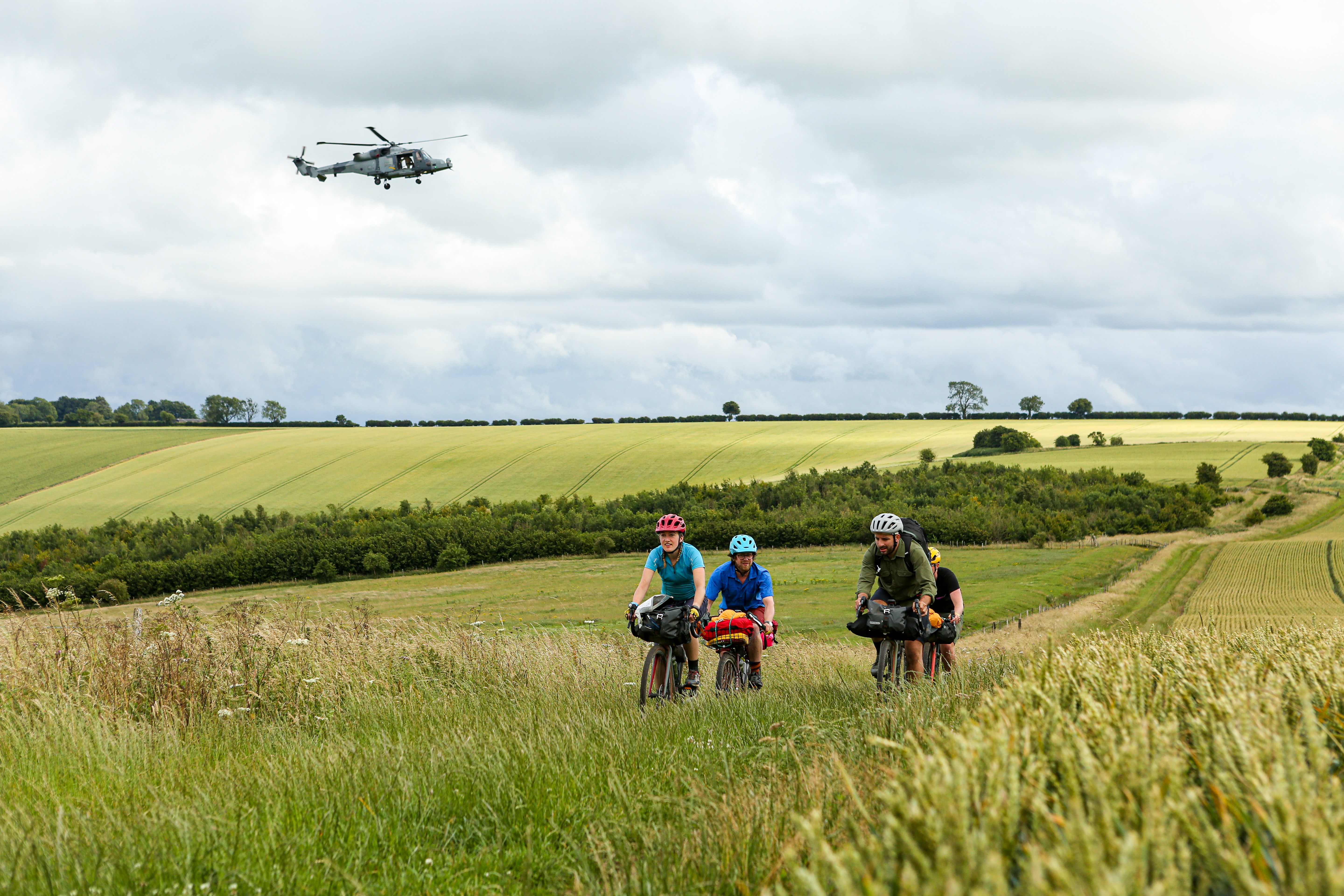
Are there any safety issues I should be aware of?
The route passes through some areas of land owned by the Ministry of Defence where there may be military training exercises going on, so make sure you pay attention to any warning signs, stick to the main route rather than wandering off, and don’t touch any ‘interesting’ objects lying around.
Salisbury Plain is a live firing range with very real dangers, so you should never cut across it if the red flags are flying.
You’ll need to be reasonably self-sufficient for Salisbury Plain and the Ridgeway, as it can be a bit of a detour to stock up. Those sections are also fairly exposed if the weather is bad.
Can I walk it rather than cycle?
While King Alfred’s Way was planned as a cycle route, it can also be enjoyed as a long-distance walking route. There are a couple of things to bear in mind if you’re planning to walk:
- There are sections on rural lanes where there were no nearby bridleways or cycle paths, where you might prefer to divert onto parallel footpaths for safety and a softer surface underfoot. You can see the route in detail on Ordnance Survey maps in the printed route guide, or on the OS Maps website if you have a premium account.
- Salisbury Plain and the Ridgeway are quite exposed and it can be some distance between refuelling stops, so make sure you are able to carry enough provisions.
Can I ride it with a child’s trailer?
Some of the trails are very narrow and can be overgrown in summer, so you might struggle with the width of a two- or three-wheeled trailer – and it could be a bumpy ride for your passengers!
We do know it is possible with a dog and an e-cargo bike, though. The video also gives you a good idea of the terrain to help you decide.
If I start and finish in Winchester, is there somewhere to leave a car for a few days?
Advice from Visit Winchester:
“The best option is to contact Winchester parking office in advance on 01962 840 222, who will be able to advise. When the parking office is closed, it is advisable to park in the Chesil multi-storey carpark and use the Pay By Phone provider to pay for the parking. When the (virtual) ticket expires, it can be renewed by phone – as long as there is a signal.”
Popular content